

Comum · Lugares
Asir Mountains
Mountain range
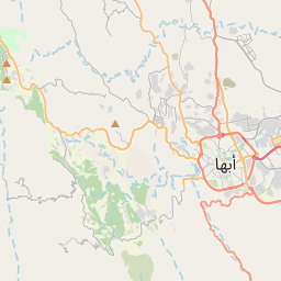
The Asir Mountains (Arabic: جِبَال عَسِيْر, jibāl ʿasīr; Arabic pronunciation: [d͡ʒɪbaːl ʕasiːr] ('Difficult')) is a mountainous region in southwestern Saudi Arabia running parallel to the Red Sea. It comprises areas in the Asir Province, but generally, it also includes areas near the border with Yemen.
No mapa
Na Wikipédia
Texto em inglês Ainda não há artigo no teu idioma: trecho em inglês.
The Asir Mountains (Arabic: جِبَال عَسِيْر, jibāl ʿasīr; Arabic pronunciation: [d͡ʒɪbaːl ʕasiːr] ('Difficult')) is a mountainous region in southwestern Saudi Arabia running parallel to the Red Sea. It comprises areas in the Asir Province, but generally, it also includes areas near the border with Yemen. The mountains cover approximately 100,000 square kilometres (40,000 mi) and consists of mountains, plains, and valleys of the Arabian highlands. Broadly, they are part of the Sarawat Mountains, defining the latter as the mountain range which runs parallel to the Tihamah throughout the western portion of the Arabian Peninsula, particularly the western parts of Saudi Arabia and Yemen. The mountains consist primarily of sedimentary rock, limestone, sandstone and shale, of Jurassic, Cretaceous and Paleogene origin on a Precambrian granitic basement. The region has the highest average rainfall of Saudi Arabia due to largely seasonal rain. Average rainfall can range from 600 millimetres (24 in) to over 1,000 millimetres (39 in) per year, in wet regions. The eastern plains and plateaus receive much lower amounts, from 500 millimetres (20 in) to below 100 millimetres (3.9 in) per year. The region's crops, most of which are cultivated on steeply terraced mountainsides, include wheat, coffee, cotton, indigo, ginger, vegetables, and palms. The region also supports cattle, sheep, goats, and camels.
Texto: Wikipédia em inglês, CC BY-SA 4.0. · Imagem: marviikad (CC BY-SA 2.0) ·