

Assynt
Sparsely populated area in the south-west of Sutherland, Scotland, UK
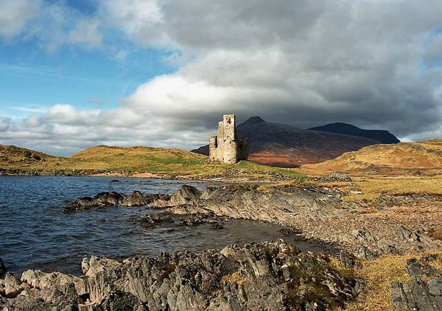
Assynt (Scottish Gaelic: Asainn [ˈas̪ɪɲ] or Asainte [ˈas̪ɪɲtʲə]) is a sparsely populated area in the south-west of Sutherland, lying north of Ullapool on the west coast of Scotland. Assynt is known for its landscape and its remarkable mountains, which have led to the area, along with neighbouring Coigach, being designated as the Assynt-Coigach National Scenic Area, one of 40 such areas in Scotland.
Nº Q745706 ★
Comum · Lugares
Assynt
Sparsely populated area in the south-west of Sutherland, Scotland, UK
Assynt (Scottish Gaelic: Asainn [ˈas̪ɪɲ] or Asainte [ˈas̪ɪɲtʲə]) is a sparsely populated area in the south-west of Sutherland, lying north of Ullapool on the west coast of Scotland. Assynt is known for its landscape and its remarkable mountains, which have led to the area, along with neighbouring Coigach, being designated as the Assynt-Coigach National Scenic Area, one of 40 such areas in Scotland.
No mapa


Na Wikipédia
Texto em inglês Ainda não há artigo no seu idioma: trecho em inglês.
Assynt (Scottish Gaelic: Asainn [ˈas̪ɪɲ] or Asainte [ˈas̪ɪɲtʲə]) is a sparsely populated area in the south-west of Sutherland, lying north of Ullapool on the west coast of Scotland. Assynt is known for its landscape and its remarkable mountains, which have led to the area, along with neighbouring Coigach, being designated as the Assynt-Coigach National Scenic Area, one of 40 such areas in Scotland. The western part of Assynt has many distinctively shaped mountains, including Quinag, Canisp, Suilven and Ben More Assynt, that rise steeply from the surrounding "cnoc and lochan" scenery. These can often appear higher than their actual height would indicate due to their steep sides and the contrast with the moorland from which they rise. Many of the most distinctive peaks such as Suilven were formed during the last Ice Age, when they were left exposed above the ice sheet as nunataks, and they now remain as inselbergs of highly eroded Torridonian sandstone sitting on a bedrock of much older Lewisian gneiss. The Moine Thrust runs through the area, and is most visible at Knockan Crag National Nature Reserve, which includes a visitor centre interpreting the geological features of the landscape. In the east of Assynt lies a region of limestone scenery surrounding Ben More Assynt. This part of Assynt hosts the longest cave in Scotland, Uamh an Claonaite, which lies five miles (eight kilometres) south of Inchnadamph. The geological importance of Assynt is reflected in its inclusion in the North West Highlands Geopark. The name Assynt may derive from an Old Norse word meaning 'ridge end'. There is also a tradition that the name comes from a fight between the two brothers Unt and Ass-Unt, (meaning Man of Peace and Man of Discord). The latter having won the tussle gave his name to the parish. It is...
Texto: Wikipédia em inglês, CC BY-SA 4.0. · Imagem: Richard Baker (CC BY-SA 2.0) ·
Cartas próximas
-

Lochinver
Village in Assynt, Highland, Scotland
Nº Q1018747 ★
Sem ofertas
-

Strontian
Human settlement in Highland, Scotland, UK
Nº Q503042 ★
Sem ofertas
-

Eas a' Chual Aluinn
Waterfall in Highland, Scotland, UK
Nº Q37820 ★
Sem ofertas
-

Knoydart
Peninsula in Highland, Scotland, UK
Nº Q2750709 ★
Sem ofertas
-

Cuillin
Mountain range on the Isle of Skye, Scotland, UK
Nº Q1143317 ★★
Sem ofertas
-

Loch Lomond
Lago na Escócia
Nº Q208926 ★★★
Sem ofertas