
Baar
Plateau in southwestern Germany
The Baar (German pronunciation: [baːɐ̯] ) is a plateau that lies 600 to 900 metres above sea level in southwest Germany. It is part of the Table Jura (Tafeljura).
Nº Q126132 ★★★
Rara · Lugares
Baar
Plateau in southwestern Germany
The Baar (German pronunciation: [baːɐ̯] ) is a plateau that lies 600 to 900 metres above sea level in southwest Germany. It is part of the Table Jura (Tafeljura).
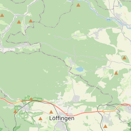
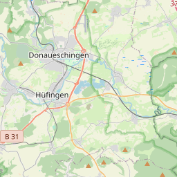
No mapa
Último preço
—
Preço mínimo
—
Mediana 7 d
—
Vendas 30 d
0
Faixa 30 d
—
Em circulação
0
Cotação
mediana
mín – máx
vendas
Sem vendas no período
Ver tabela
| Data | mediana | Mín | Máx | vendas |
|---|
Histórico de vendas
- Última venda
- —
- Média 30 d
- —
- Mínima 30 d
- —
- Máxima 30 d
- —
- Vendas 7 d
- 0
- Vendas 30 d
- 0
Ainda sem vendas.
Vendas anônimas: sem comprador nem vendedor. Os números contam só vendas entre jogadores.
Na Wikipédia
Texto em inglês Ainda não há artigo no seu idioma: trecho em inglês.
The Baar (German pronunciation: [baːɐ̯] ) is a plateau that lies 600 to 900 metres above sea level in southwest Germany. It is part of the Table Jura (Tafeljura). It is bordered by the southeastern edge of the Black Forest to the west, the southwestern part of the Swabian Alb known as the Heuberg to the east, and the Randen mountain to the south. The Baar contains the source of the Neckar (a bog in Villingen-Schwenningen) and the Danube. The sources of the Danube, the Brigach and Breg, originate in Furtwangen im Schwarzwald and Sankt Georgen im Schwarzwald and join the smaller Donaubach in Donaueschingen. The coldest point in Germany is also located at Donaueschingen in a low cold air basin which experiences its first frost as early as September 20 on average, earlier than the surrounding Black Forest.
Texto: Wikipédia em inglês, CC BY-SA 4.0. · Imagem: kyselak (CC BY-SA 3.0) ·
Cartas próximas
-

Alpes Suábios
Nº Q159589 ★★★★★
Sem ofertas
-

Table Jura
Northeastern extension of the Jura Mountains; stands in opposition to the folded Jura
Nº Q356545 ★
Sem ofertas
-

Grosser Heuberg
Nº Q1548700 ★★★
Sem ofertas
-

Baar (Baviera)
Nº Q256051 ★
Sem ofertas
-

Schwarze Laber
River in Germany
Nº Q504545 ★★
Sem ofertas
-

Distrito da Floresta Negra-Baar
Nº Q8203 ★★★
Sem ofertas