
Brody Raion
Raion of Lviv Oblast
Brody Raion (Ukrainian: Бродівський район, romanized: Brodivs'kyi raion) was a raion (district) of Lviv Oblast in western Ukraine. Its administrative center was Brody. The raion was abolished on 18 July 2020 as part of an administrative reform in Ukraine, which reduced the number of raions of Lviv Oblast to seven.
Nº Q2599799 ★★★
Rara · Lugares
Brody Raion
Raion of Lviv Oblast
Brody Raion (Ukrainian: Бродівський район, romanized: Brodivs'kyi raion) was a raion (district) of Lviv Oblast in western Ukraine. Its administrative center was Brody. The raion was abolished on 18 July 2020 as part of an administrative reform in Ukraine, which reduced the number of raions of Lviv Oblast to seven.
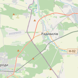
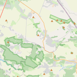
No mapa


Último preço
—
Preço mínimo
—
Mediana 7 d
—
Vendas 30 d
0
Faixa 30 d
—
Em circulação
0
Cotação
mediana
mín – máx
vendas
Sem vendas no período
Ver tabela
| Data | mediana | Mín | Máx | vendas |
|---|
Histórico de vendas
- Última venda
- —
- Média 30 d
- —
- Mínima 30 d
- —
- Máxima 30 d
- —
- Vendas 7 d
- 0
- Vendas 30 d
- 0
Ainda sem vendas.
Vendas anônimas: sem comprador nem vendedor. Os números contam só vendas entre jogadores.
Na Wikipédia
Texto em inglês Ainda não há artigo no seu idioma: trecho em inglês.
Brody Raion (Ukrainian: Бродівський район, romanized: Brodivs'kyi raion) was a raion (district) of Lviv Oblast in western Ukraine. Its administrative center was Brody. The raion was abolished on 18 July 2020 as part of an administrative reform in Ukraine, which reduced the number of raions of Lviv Oblast to seven. The area of Brody Raion was merged into Zolochiv Raion. The last estimate of the population of the raion was 57,457 (2020 est.). The raion was located at the easternmost portion of Lviv Oblast, bordering Rivne and Ternopil Oblasts to its east, Volyn Oblast to the north, Radekhiv Raion to the northwest, Busk Raion to the west, and Zolochiv Raion to the southwest. Historically, the district (county) had been known as a border checkpoint between the Austria-Hungary Empire and the Russian Empire. As a county (powiat), it was established in 1866 as part of the Kingdom of Galicia and Lodomeria. After World War I, the area became part of the Second Polish Republic's Tarnopol Voivodeship. During the invasion of Soviet forces at the beginning of World War II, the district was established by the Soviet administration. The raion had a city administrative area, a "town with three other villages" administrative area and 23 rural councils which were formed out of the rest of the 73 villages. Some councils included up to 10 villages (Ponykva), while some consisted only of a pair of villages.
Texto: Wikipédia em inglês, CC BY-SA 4.0. · Imagem: Olegzima (Public domain) ·
Cartas próximas

Zolochiv Raion
Raion in Lviv Oblast, Ukraine (established in 2020)
Nº Q103839840 ★

Mykolaiv Raion, Lviv Oblast
Raion in Lviv Oblast, Ukraine
Nº Q2991149 ★★★

Staryi Sambir Raion
Raion in Lviv Oblast, Ukraine
Nº Q2599775 ★★★

Radekhiv Raion
Raion in Lviv Oblast, Ukraine
Nº Q2599711 ★★★

Zhovkva Raion
Former raion of Ukraine
Nº Q955630 ★★★

Mostyska Raion
Raion in Lviv Oblast, Ukraine
Nº Q2599836 ★★★