
Cascadia subduction zone
Plate boundary
The Cascadia subduction zone is a 620-mile (1,000 km) long convergent plate boundary, about 70–100 miles (110–160 kilometers) off the Pacific coast of North America, that stretches from northern Vancouver Island in Canada to Northern California in the United States. It is capable of producing 9.0+ magnitude earthquakes and tsunamis that could reach 100 feet (30 m) high.
Nº Q4024718 ★★★
Rara · Lugares
Cascadia subduction zone
Plate boundary
The Cascadia subduction zone is a 620-mile (1,000 km) long convergent plate boundary, about 70–100 miles (110–160 kilometers) off the Pacific coast of North America, that stretches from northern Vancouver Island in Canada to Northern California in the United States. It is capable of producing 9.0+ magnitude earthquakes and tsunamis that could reach 100 feet (30 m) high.
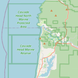
No mapa

Último preço
—
Preço mínimo
—
Mediana 7 d
—
Vendas 30 d
0
Faixa 30 d
—
Em circulação
0
Cotação
mediana
mín – máx
vendas
Sem vendas no período
Ver tabela
| Data | mediana | Mín | Máx | vendas |
|---|
Histórico de vendas
- Última venda
- —
- Média 30 d
- —
- Mínima 30 d
- —
- Máxima 30 d
- —
- Vendas 7 d
- 0
- Vendas 30 d
- 0
Ainda sem vendas.
Vendas anônimas: sem comprador nem vendedor. Os números contam só vendas entre jogadores.
Na Wikipédia
Texto em inglês Ainda não há artigo no seu idioma: trecho em inglês.
The Cascadia subduction zone is a 620-mile (1,000 km) long convergent plate boundary, about 70–100 miles (110–160 kilometers) off the Pacific coast of North America, that stretches from northern Vancouver Island in Canada to Northern California in the United States. It is capable of producing 9.0+ magnitude earthquakes and tsunamis that could reach 100 feet (30 m) high. The Oregon Department of Emergency Management estimates shaking would last 5–7 minutes along the coast, with strength and intensity decreasing further from the epicenter. It is a very long, sloping subduction zone where the Explorer, Juan de Fuca, and Gorda plates move to the east and slide below the much larger, mostly continental North American plate. The zone varies in width and lies offshore beginning near Cape Mendocino, Northern California, passing through Oregon and Washington, and terminating in Canada at about Vancouver Island in British Columbia. The Explorer, Juan de Fuca, and Gorda plates are some of the remnants of the vast ancient Farallon plate which is now mostly subducted under the North American plate. The North American plate itself is moving slowly in a generally southwest direction, sliding over the smaller plates as well as the huge oceanic Pacific plate (which is moving in a northwest direction) in other locations such as the San Andreas Fault in central and southern California. Tectonic processes active in the Cascadia subduction zone region include accretion, subduction, deep earthquakes, and active volcanism of the Cascades. This volcanism has included such notable eruptions as Mount Mazama (Crater Lake) about 7,500 years ago, the Mount Meager massif (Bridge River Vent) about 2,350 years ago, and Mount St. Helens in 1980. Major cities affected by a disturbance in this subduction zone include Vancouver and Victoria, British Columbia; Seattle and Tacoma, Washington; and Portland, Oregon.
Texto: Wikipédia em inglês, CC BY-SA 4.0. · Imagem: Alicia.iverson (CC BY-SA 4.0) ·
Cartas próximas

Cascade Volcanoes
Chain of volcanoes in western North America
Nº Q769008 ★★

Cascadia (bioregion)
Bioregion in North America
Nº Q16956033 ★★

Noroeste Pacífico
Região da América do Norte ocidental
Nº Q12603 ★★★★

Sunda megathrust
Geological feature
Nº Q7639115 ★

1700 Cascadia earthquake
January 1700 megathrust earthquake affecting the North American Pacific North West coast
Nº Q1735004 ★★★★

Falha de Santo André
Falha geológica na Califórnia
Nº Q191218 ★★★★★★