
Crewkerne
Town in Somerset, England
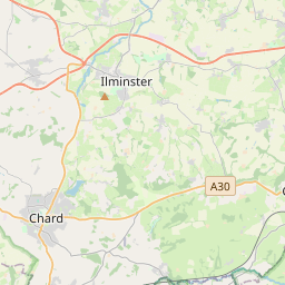
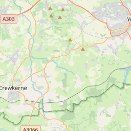
Crewkerne ( KROO-kərn) is a town and electoral ward in south Somerset, England, 9 miles (14 km) southwest of Yeovil and 7 miles (11 km) east of Chard. A separate civil parish of West Crewkerne includes the hamlets of Clapton, Coombe, Woolminstone and Henley, and borders the county of Dorset to the south.
Nº Q1234905 ★★
Incomum · Lugares
Crewkerne
Town in Somerset, England
Crewkerne ( KROO-kərn) is a town and electoral ward in south Somerset, England, 9 miles (14 km) southwest of Yeovil and 7 miles (11 km) east of Chard. A separate civil parish of West Crewkerne includes the hamlets of Clapton, Coombe, Woolminstone and Henley, and borders the county of Dorset to the south.
No mapa
Último preço
—
Preço mínimo
—
Mediana 7 d
—
Vendas 30 d
0
Faixa 30 d
—
Em circulação
0
Cotação
mediana
mín – máx
vendas
Sem vendas no período
Ver tabela
| Data | mediana | Mín | Máx | vendas |
|---|
Histórico de vendas
- Última venda
- —
- Média 30 d
- —
- Mínima 30 d
- —
- Máxima 30 d
- —
- Vendas 7 d
- 0
- Vendas 30 d
- 0
Ainda sem vendas.
Vendas anônimas: sem comprador nem vendedor. Os números contam só vendas entre jogadores.
Na Wikipédia
Texto em inglês Ainda não há artigo no seu idioma: trecho em inglês.
Crewkerne ( KROO-kərn) is a town and electoral ward in south Somerset, England, 9 miles (14 km) southwest of Yeovil and 7 miles (11 km) east of Chard. A separate civil parish of West Crewkerne includes the hamlets of Clapton, Coombe, Woolminstone and Henley, and borders the county of Dorset to the south. The town is on the main headwater of the River Parrett, the A30 road and the West of England railway line. The earliest written record of Crewkerne is in the 899 will of Alfred the Great who left it to his youngest son Æthelweard. After the Norman Conquest it was held by William the Conqueror and in the Domesday Survey of 1086 was described as a royal manor. Crewkerne Castle was possibly a Norman motte castle. The town grew up in the late mediaeval period around the textile industry, its wealth demonstrated in the 15th-century Church of St Bartholomew. During the 18th and 19th centuries the main industry was cloth making, including webbing, and sails for the Royal Navy. Local ecological sites include the Bincombe Beeches local nature reserve and the Millwater biological Site of Special Scientific Interest. Crewkerne railway station is served by South Western Railway. The town is the birthplace of several notable people and has varied cultural and sporting facilities including those at Wadham School.
Texto: Wikipédia em inglês, CC BY-SA 4.0. · Imagem: Mike Searle (CC BY-SA 2.0) ·
Cartas próximas

Sherborne
Town and civil parish in Dorset, England
Nº Q586895 ★★

Leatherhead
Town in Surrey, England
Nº Q1810766 ★★

Somerset
Nº Q23157 ★★★★

Camberwell
Area of south London, England, in the London Borough of Southwark and the London Borough of Lambeth
Nº Q385060 ★★

Bridgwater
Nº Q914015 ★★

Guildford
Nº Q213465 ★★★