
Igman
Mountain plateau in central Bosnia and Herzegovina
Igman (Serbian Cyrillic: Игман, pronounced [îɡman]) is a mountain plateau in central Bosnia and Herzegovina. Geologically, Igman is part of the Dinaric Alps and formed largely of secondary and tertiary sedimentary rock, mostly Limestone.
Nº Q1110607 ★★
Incomum · Lugares
Igman
Mountain plateau in central Bosnia and Herzegovina
Igman (Serbian Cyrillic: Игман, pronounced [îɡman]) is a mountain plateau in central Bosnia and Herzegovina. Geologically, Igman is part of the Dinaric Alps and formed largely of secondary and tertiary sedimentary rock, mostly Limestone.
No mapa
Último preço
—
Preço mínimo
—
Mediana 7 d
—
Vendas 30 d
0
Faixa 30 d
—
Em circulação
0
Cotação
mediana
mín – máx
vendas
Sem vendas no período
Ver tabela
| Data | mediana | Mín | Máx | vendas |
|---|
Histórico de vendas
- Última venda
- —
- Média 30 d
- —
- Mínima 30 d
- —
- Máxima 30 d
- —
- Vendas 7 d
- 0
- Vendas 30 d
- 0
Ainda sem vendas.
Vendas anônimas: sem comprador nem vendedor. Os números contam só vendas entre jogadores.
Na Wikipédia
Texto em inglês Ainda não há artigo no seu idioma: trecho em inglês.
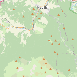
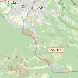
Igman (Serbian Cyrillic: Игман, pronounced [îɡman]) is a mountain plateau in central Bosnia and Herzegovina. Geologically, Igman is part of the Dinaric Alps and formed largely of secondary and tertiary sedimentary rock, mostly Limestone. It is located southwest of Sarajevo, bordering the Bjelašnica range in the south and west, Hadžići and Ilidža in the north, and the river Željeznica in the east. Igman's highest point, Crni vrh, west of the Malo Polje road, at an altitude of 1,510 metres (4,954 feet), the homonym highest elevation on the east side of this road reaches an elevation of 1,502 metres (4,928 feet). Most of Igman is covered with mixed forest with local pastures (f.i.: Veliko Polje: Large Field, Malo Polje: Small Field). Igman was the location of the lowest recorded temperature in the region, −43 °C (−45 °F). Igman was the site of extensive combat during the 1992-95 Siege of Sarajevo and certain areas, in particular the surroundings of former front lines, constitute a high mine risk.
Texto: Wikipédia em inglês, CC BY-SA 4.0. · Imagem: Xe0us at English Wikipedia (CC BY-SA 3.0) ·
Cartas próximas
-

Bjelašnica
Mountain range in central Bosnia and Herzegovina
Nº Q879414 ★★
Sem ofertas
-

Igman Olympic Jumps
Nº Q1657209 ★
Sem ofertas
-

Salto de esqui nos Jogos Olímpicos de Inverno de 1984
Nº Q1042143 ★★
Sem ofertas
-

Jahorina
Mountain range in Bosnia and Herzegovina
Nº Q187944 ★★
Sem ofertas
-

Trebević
Mountain in Bosnia and Herzegovina
Nº Q612240 ★★
Sem ofertas
-

Vrelo Bosne
Protected area in Bosnia and Herzegovina
Nº Q108146920 ★
Sem ofertas