
Muara Jawa
District in Kutai Kartanegara Regency, East Kalimantan Province, Indonesia
Muara Jawa is an administrative district {kecamatan) in Kutai Kartanegara Regency, East Kalimantan, Indonesia. It held 33,923 inhabitants as at the 2010 Census, and 41,561 inhabitants at the 2020 Census. As of 2025, it was inhabited by 49,317 people, and currently has the total land area of 619.16 km2.
Nº Q13405043 ★★★
Rara · Lugares
Muara Jawa
District in Kutai Kartanegara Regency, East Kalimantan Province, Indonesia
Muara Jawa is an administrative district {kecamatan) in Kutai Kartanegara Regency, East Kalimantan, Indonesia. It held 33,923 inhabitants as at the 2010 Census, and 41,561 inhabitants at the 2020 Census. As of 2025, it was inhabited by 49,317 people, and currently has the total land area of 619.16 km2.
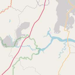
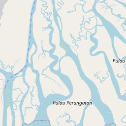
No mapa


Último preço
—
Preço mínimo
—
Mediana 7 d
—
Vendas 30 d
0
Faixa 30 d
—
Em circulação
0
Cotação
mediana
mín – máx
vendas
Sem vendas no período
Ver tabela
| Data | mediana | Mín | Máx | vendas |
|---|
Histórico de vendas
- Última venda
- —
- Média 30 d
- —
- Mínima 30 d
- —
- Máxima 30 d
- —
- Vendas 7 d
- 0
- Vendas 30 d
- 0
Ainda sem vendas.
Vendas anônimas: sem comprador nem vendedor. Os números contam só vendas entre jogadores.
Na Wikipédia
Texto em inglês Ainda não há artigo no seu idioma: trecho em inglês.
Muara Jawa is an administrative district {kecamatan) in Kutai Kartanegara Regency, East Kalimantan, Indonesia. It held 33,923 inhabitants as at the 2010 Census, and 41,561 inhabitants at the 2020 Census. As of 2025, it was inhabited by 49,317 people, and currently has the total land area of 619.16 km2. Its district seat is located at the village of Muara Jawa Ulu. The district is situated to the south of the major city of Samarinda, and borders the districts of Sanga-Sanga to the north, Loa Janan to the east, and Samboja to the south. To the east it borders upon the numerous large islands in the widespread estuary of the Mahakam River where it discharges into the Makassar Strait. Of the many islands which comprise the estuary, which it shares with Anggana District, those in the southern part of the estuary (notably Bukuan, Cerocok, Kerbau, Layangan, Merdeka, South Merdeka, Central Merdeka, North Merdeka, Muaraulu, Nibung, Pegah, Greater Perangatan and Lesser Perangatan islands) belong to Muara Jawa District. From 24 April 1969 until 21 October 1987, Muara Jawa belonged to Samarinda, along with Sanga-Sanga and Samboja Districts, until these districts were returned to Kutai Kartanegara on that date.
Texto: Wikipédia em inglês, CC BY-SA 4.0. · Imagem: Ezagren (bicara / talk) (Attribution) ·
Cartas próximas

Muara Kaman
District in Kutai Kartanegara Regency, East Kalimantan Province, Indonesia
Nº Q12499189 ★★★★

Muara Badak
District in Kutai Kartanegara Regency, East Kalimantan Province, Indonesia
Nº Q11028622 ★★★

Loa Janan
District in Kutai Kartanegara Regency, East Kalimantan Province, Indonesia
Nº Q3359155 ★★★

Muara Komam
District in Paser Regency, East Kalimantan Province, Indonesia
Nº Q12499196 ★★★
Muaragembong
District in Bekasi Regency, West Java Province, Indonesia
Nº Q216154 ★★★

Anggana
District in Kutai Kartanegara Regency, East Kalimantan Province, Indonesia
Nº Q4201401 ★★★