
Oostpoort
Neighborhood in Amsterdam, Netherlands
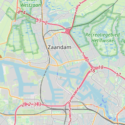
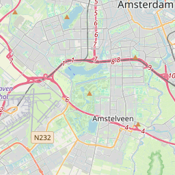
Oostpoort (Dutch pronunciation: [oːstpoːrt]; English: East Gate) is a neighborhood in the borough Amsterdam-Oost in Amsterdam, Netherlands. The neighborhood is situated at 52°21′28″N 4°55′53″E between the Linnaeusstraat, the Ringvaart, the Amsterdam–Arnhem railway, and the Amsterdam–Zutphen railway.
Nº Q3119620 ★★
Incomum · Lugares
Oostpoort
Neighborhood in Amsterdam, Netherlands
Oostpoort (Dutch pronunciation: [oːstpoːrt]; English: East Gate) is a neighborhood in the borough Amsterdam-Oost in Amsterdam, Netherlands. The neighborhood is situated at 52°21′28″N 4°55′53″E between the Linnaeusstraat, the Ringvaart, the Amsterdam–Arnhem railway, and the Amsterdam–Zutphen railway.
No mapa
Último preço
—
Preço mínimo
—
Mediana 7 d
—
Vendas 30 d
0
Faixa 30 d
—
Em circulação
0
Cotação
mediana
mín – máx
vendas
Sem vendas no período
Ver tabela
| Data | mediana | Mín | Máx | vendas |
|---|
Histórico de vendas
- Última venda
- —
- Média 30 d
- —
- Mínima 30 d
- —
- Máxima 30 d
- —
- Vendas 7 d
- 0
- Vendas 30 d
- 0
Ainda sem vendas.
Vendas anônimas: sem comprador nem vendedor. Os números contam só vendas entre jogadores.
Na Wikipédia
Texto em inglês Ainda não há artigo no seu idioma: trecho em inglês.
Oostpoort (Dutch pronunciation: [oːstpoːrt]; English: East Gate) is a neighborhood in the borough Amsterdam-Oost in Amsterdam, Netherlands. The neighborhood is situated at 52°21′28″N 4°55′53″E between the Linnaeusstraat, the Ringvaart, the Amsterdam–Arnhem railway, and the Amsterdam–Zutphen railway. Initially, the area was named Polderweggebied after the Polderweg, which is a road running through it. Between 1885 and 1921, the Oostergasfabriek (Eastern Gas Factory) was located in the area. After the factory was closed, the neighborhood became a business area. In the early 2000s, multiple buildings were demolished and the terrain was remediated. In 2007, the first new buildings were constructed. In 2008, the neighborhood was renamed Oostpoort. In 2013, Oostpoort had a population of 573. The local government is expecting the population to peak with 2,274 in the year 2020. The district office (Dutch: stadsdeelkantoor) of Amsterdam-Oost, a shopping area, one primary school, and two secondary schools are located in Oostpoort.
Texto: Wikipédia em inglês, CC BY-SA 4.0. · Imagem: Sergé Technau (CC BY-SA 4.0) ·
Cartas próximas
Oostzanerwerf
Neighborhood in Amsterdam, the Netherlands
Nº Q1613616 ★★

Eastern Docklands
Neighborhood in Amsterdam, Netherlands
Nº Q3070648 ★★★

Linha 50 do Metro de Amesterdão
Nº Q2466111 ★★★

Amsterdam–Zutphen railway
Railway line in the Netherlands
Nº Q801845 ★

Amsterdam Nieuw-West
Borough of Amsterdam, Netherlands
Nº Q478593 ★★★★
Oud-Oost
Neighborhood in Amsterdam, Netherlands
Nº Q7110254 ★★