
Pilibhit
City
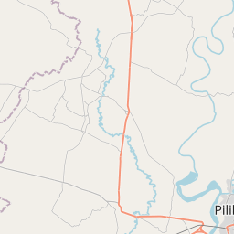
Pilibhit (pronounced [piːliːbʱiːt̪] ) is a city and a municipal board in Pilibhit district in the northern Indian state of Uttar Pradesh. Pilibhit is the north-easternmost district of Bareilly division, situated in the Rohilkhand region of the sub-Himalayan Plateau belt next to foothills of Sivalik Range on the boundary of Nepal, known for the origin of river Gomati and one of the most forest-rich areas in North India.
Nº Q1197824 ★
Comum · Lugares
Pilibhit
City
Pilibhit (pronounced [piːliːbʱiːt̪] ) is a city and a municipal board in Pilibhit district in the northern Indian state of Uttar Pradesh. Pilibhit is the north-easternmost district of Bareilly division, situated in the Rohilkhand region of the sub-Himalayan Plateau belt next to foothills of Sivalik Range on the boundary of Nepal, known for the origin of river Gomati and one of the most forest-rich areas in North India.
No mapa
Último preço
—
Preço mínimo
—
Mediana 7 d
—
Vendas 30 d
0
Faixa 30 d
—
Em circulação
0
Cotação
mediana
mín – máx
vendas
Sem vendas no período
Ver tabela
| Data | mediana | Mín | Máx | vendas |
|---|
Histórico de vendas
- Última venda
- —
- Média 30 d
- —
- Mínima 30 d
- —
- Máxima 30 d
- —
- Vendas 7 d
- 0
- Vendas 30 d
- 0
Ainda sem vendas.
Vendas anônimas: sem comprador nem vendedor. Os números contam só vendas entre jogadores.
Na Wikipédia
Texto em inglês Ainda não há artigo no seu idioma: trecho em inglês.
Pilibhit (pronounced [piːliːbʱiːt̪] ) is a city and a municipal board in Pilibhit district in the northern Indian state of Uttar Pradesh. Pilibhit is the north-easternmost district of Bareilly division, situated in the Rohilkhand region of the sub-Himalayan Plateau belt next to foothills of Sivalik Range on the boundary of Nepal, known for the origin of river Gomati and one of the most forest-rich areas in North India. Pilibhit was also known as Bansuri Nagari – the land of flutes, for making and exporting roughly 95% of India's flutes. According to a report issued by the Government of India, Pilibhit is one of the Minority Concentrated Areas in India based on the 2001 census data on population, socio-economic indicators, and basic amenities indicators. Though separated only by a short distance from the outer ranges of the Himalayas, Pilibhit consists entirely of a level plain, containing depressions but no hills and is intersected by several streams. Pilibhit is one of the forest-rich areas of Uttar Pradesh. The almost 54 km-long Indo-Nepal international border makes Pilibhit a highly sensitive for security purposes. According to an estimate by the Government of India, Pilibhit has 45.23% of its population living under the poverty line as of July 2007. Increasing population and unemployment is a cause of worry in the area, and many non-governmental organizations (NGOs) and government-run organizations have initiated projects to provide employment, but human resources are yet to be exploited in full. The city came third-bottom in terms of hygiene and sanitation in a Government ranking list of 423 towns and cities in India.
Texto: Wikipédia em inglês, CC BY-SA 4.0. · Imagem: Shamikh Faraz (CC BY 3.0) ·
Cartas próximas
-

Pilibhit district
District of Uttar Pradesh, India
Nº Q2980705 ★
Sem ofertas
-

Bareilly district
District of Uttar Pradesh, India
Nº Q1797378 ★
Sem ofertas
-

Uttarkashi district
District of Uttarakhand, India
Nº Q1773437 ★
Sem ofertas
-

Bareilly division
Division of Uttar Pradesh, India
Nº Q41275 ★
Sem ofertas
-

Pithoragarh district
District of Uttarakhand, India
Nº Q1945425 ★
Sem ofertas
-

Gomti River
River in India
Nº Q477676 ★
Sem ofertas