
Rodenkirchen
City district of Cologne No. 2
Rodenkirchen (German pronunciation: [ʁoːdn̩ˈkɪʁçn̩]) is a southern borough (Stadtbezirk) of Cologne (Köln) in Germany. It has about 110,000 inhabitants and covers an area of 54.55 square kilometres (21.06 square miles).
Nº Q446716 ★★★
Rara · Lugares
Rodenkirchen
City district of Cologne No. 2
Rodenkirchen (German pronunciation: [ʁoːdn̩ˈkɪʁçn̩]) is a southern borough (Stadtbezirk) of Cologne (Köln) in Germany. It has about 110,000 inhabitants and covers an area of 54.55 square kilometres (21.06 square miles).
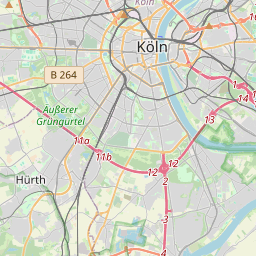
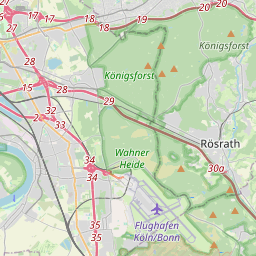
No mapa
Último preço
—
Preço mínimo
—
Mediana 7 d
—
Vendas 30 d
0
Faixa 30 d
—
Em circulação
0
Cotação
mediana
mín – máx
vendas
Sem vendas no período
Ver tabela
| Data | mediana | Mín | Máx | vendas |
|---|
Histórico de vendas
- Última venda
- —
- Média 30 d
- —
- Mínima 30 d
- —
- Máxima 30 d
- —
- Vendas 7 d
- 0
- Vendas 30 d
- 0
Ainda sem vendas.
Vendas anônimas: sem comprador nem vendedor. Os números contam só vendas entre jogadores.
Na Wikipédia
Texto em inglês Ainda não há artigo no seu idioma: trecho em inglês.
Rodenkirchen (German pronunciation: [ʁoːdn̩ˈkɪʁçn̩]) is a southern borough (Stadtbezirk) of Cologne (Köln) in Germany. It has about 110,000 inhabitants and covers an area of 54.55 square kilometres (21.06 square miles). The borough includes the quarters Bayenthal, Godorf, Hahnwald, Immendorf, Marienburg, Meschenich, Raderberg, Raderthal, Rodenkirchen, Sürth, Rondorf, Weiß and Zollstock. The 1000-year-old quarter Rodenkirchen, situated close to the Rhine, today represents the center of the borough. It has more than 16,000 inhabitants.
Texto: Wikipédia em inglês, CC BY-SA 4.0. · Imagem: Duhon (CC BY 3.0) ·
Cartas próximas

Zollstock
City quarter No. 205 of Cologne
Nº Q1171034 ★★★

Lindenthal (Colônia (Alemanha))
Nº Q518491 ★★★

Porz
City district of Cologne No. 7, Germany
Nº Q458242 ★★★

Rothenburgsort
Quarter in Hamburg-Mitte, Hamburg, Germany
Nº Q1580 ★★★

Sülz
City quarter No. 302 of Cologne, Germany
Nº Q633582 ★★★
Lindenthal
City quarter No. 303 of Cologne, Germany, and subdivision of city district Lindenthal
Nº Q547481 ★★★