
The Barrier
Cliff in British Columbia, Canada
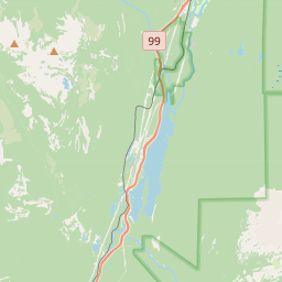
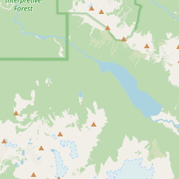
The Barrier is a lava dam retaining the Garibaldi Lake system in southwestern British Columbia, Canada. It is about 80 kilometres (50 miles) north of Vancouver in Garibaldi Provincial Park of New Westminster Land District.
Nº Q6966022 ★
Comum · Lugares
The Barrier
Cliff in British Columbia, Canada
The Barrier is a lava dam retaining the Garibaldi Lake system in southwestern British Columbia, Canada. It is about 80 kilometres (50 miles) north of Vancouver in Garibaldi Provincial Park of New Westminster Land District.
No mapa


Último preço
—
Preço mínimo
—
Mediana 7 d
—
Vendas 30 d
0
Faixa 30 d
—
Em circulação
0
Cotação
mediana
mín – máx
vendas
Sem vendas no período
Ver tabela
| Data | mediana | Mín | Máx | vendas |
|---|
Histórico de vendas
- Última venda
- —
- Média 30 d
- —
- Mínima 30 d
- —
- Máxima 30 d
- —
- Vendas 7 d
- 0
- Vendas 30 d
- 0
Ainda sem vendas.
Vendas anônimas: sem comprador nem vendedor. Os números contam só vendas entre jogadores.
Na Wikipédia
Texto em inglês Ainda não há artigo no seu idioma: trecho em inglês.
The Barrier is a lava dam retaining the Garibaldi Lake system in southwestern British Columbia, Canada. It is about 80 kilometres (50 miles) north of Vancouver in Garibaldi Provincial Park of New Westminster Land District. The Barrier lies in the Cheakamus River watershed of the southern Coast Mountains where snow-capped mountains, diverse vegetation and rich geological history exist. Garibaldi Lake is the largest lake impounded by The Barrier; it has a length of 5.23 km (3.25 mi) and a width of 2.4 km (1.5 mi). The much smaller Lesser Garibaldi and Barrier lakes are also impounded by The Barrier. However, they lie within depressions on the surface of the lava dam rather than behind it. All three lakes are drained by Rubble Creek, a tributary of the Cheakamus River flowing northwest from the foot of The Barrier. The Barrier formed about 13,000 years ago when lava flowed into Rubble Creek valley. It then ponded and cooled against the retreating Cordilleran Ice Sheet, resulting in the lava flow being unusually thick. The source of the lava flow was Clinker Peak on the western shoulder of Mount Price, a stratovolcano reaching an elevation of 2,049 metres (6,722 feet). In 1855–1856, The Barrier was the source of a large rock avalanche that travelled down Rubble Creek valley to the Cheakamus River. This collapse of the lava dam created its current headwall; it rises about 500 m (1,600 ft) above the floor of Rubble Creek valley. The headwall has been highly unstable since the 1855–1856 landslide, having been the site of several rockfalls. Debris from these rockfalls has formed a talus deposit at the base of the headwall. Concerns about The Barrier's instability prompted the provincial government to declare the area immediately below it unsafe for human habitation in 1980–1981. This led to the...
Texto: Wikipédia em inglês, CC BY-SA 4.0. · Imagem: JohnHarvey (CC BY-SA 2.5) ·


