
Wicklow Mountains
Mountain range in Ireland
The Wicklow Mountains (Irish: Sléibhte Chill Mhantáin, archaic: Cualu) form the largest continuous upland area in Ireland. They occupy the whole centre of County Wicklow and stretch outside its borders into the counties of Dublin, Wexford and Carlow.
Nº Q945002 ★★
Incomum · Lugares
Wicklow Mountains
Mountain range in Ireland
The Wicklow Mountains (Irish: Sléibhte Chill Mhantáin, archaic: Cualu) form the largest continuous upland area in Ireland. They occupy the whole centre of County Wicklow and stretch outside its borders into the counties of Dublin, Wexford and Carlow.
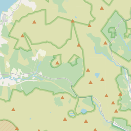
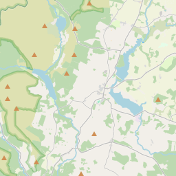
No mapa
Último preço
—
Preço mínimo
—
Mediana 7 d
—
Vendas 30 d
0
Faixa 30 d
—
Em circulação
0
Cotação
mediana
mín – máx
vendas
Sem vendas no período
Ver tabela
| Data | mediana | Mín | Máx | vendas |
|---|
Histórico de vendas
- Última venda
- —
- Média 30 d
- —
- Mínima 30 d
- —
- Máxima 30 d
- —
- Vendas 7 d
- 0
- Vendas 30 d
- 0
Ainda sem vendas.
Vendas anônimas: sem comprador nem vendedor. Os números contam só vendas entre jogadores.
Na Wikipédia
Texto em inglês Ainda não há artigo no seu idioma: trecho em inglês.
The Wicklow Mountains (Irish: Sléibhte Chill Mhantáin, archaic: Cualu) form the largest continuous upland area in Ireland. They occupy the whole centre of County Wicklow and stretch outside its borders into the counties of Dublin, Wexford and Carlow. Where the mountains extend into County Dublin, they are known locally as the Dublin Mountains (Sléibhte Bhaile Átha Cliath). The highest peak is Lugnaquilla at 925 metres (3,035 feet). The mountains are primarily composed of granite surrounded by an envelope of mica-schist and much older rocks such as quartzite. They were pushed up during the Caledonian orogeny at the start of the Devonian period and form part of the Leinster Chain, the largest continuous area of granite in Ireland and Britain. The mountains owe much of their present topography to the effects of the last ice age, which deepened the glens and created corrie and ribbon lakes. Copper and lead have been the main metals mined in the mountains and a brief gold rush occurred in the 18th century. Several major river systems have their source in the mountains, such as the Liffey, Dargle, Slaney and Avoca rivers. Powerscourt Waterfall is the second tallest in Ireland at 121 metres (397 feet). A number of these rivers have been harnessed to create reservoirs for drinking water for Dublin and its surroundings. The Wicklow Mountains experience a temperate oceanic climate with mild, damp summers and cool, wet winters. The dominant habitat of the uplands consists of blanket bog, heath and upland grassland. The uplands support a number of bird species, including merlin and peregrine falcon. The valleys are a mixture of coniferous and deciduous woodland. The mountains have been inhabited since Neolithic times and a number of typical monuments, in particular a series of passage tombs, survive to the present day. The monastery at...
Texto: Wikipédia em inglês, CC BY-SA 4.0. · Imagem: Joe King (CC BY-SA 3.0) ·
Cartas próximas
-

Macgillycuddy's Reeks
Nº Q1366878 ★★
Sem ofertas
-

Wicklow
Nº Q652101 ★★
Sem ofertas
-

Greystones
Town in County Wicklow, Ireland
Nº Q938017 ★★
Sem ofertas
-

Wicklow Mountains National Park
220-square-kilometre (54,000-acre) protected area in Ireland
Nº Q3364505 ★
Sem ofertas
-

Galtymore
Mountain in Tipperary/Limerick, Ireland
Nº Q2333034 ★
Sem ofertas
-

Condado de Wicklow
Condado na Irlanda
Nº Q182591 ★★
Sem ofertas