
Abyysky District
Human settlement in Russia
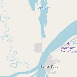
Abyysky District (Russian: Абы́йский улу́с; Yakut: Абый улууһа, Abıy uluuha, Yakut pronunciation: [abɯj uluːha]) is an administrative and municipal district (raion, or ulus), one of the thirty-four in the Sakha Republic, Russia. It is located in the north of the republic around the Indigirka River and borders with Allaikhovsky District in the north, Srednekolymsky District in the east, Verkhnekolymsky District in the southeast, Momsky District in the south, and with Ust-Yansky District in the west.
Nº Q480278 ★★
Uncommon · Places
Abyysky District
Human settlement in Russia
Abyysky District (Russian: Абы́йский улу́с; Yakut: Абый улууһа, Abıy uluuha, Yakut pronunciation: [abɯj uluːha]) is an administrative and municipal district (raion, or ulus), one of the thirty-four in the Sakha Republic, Russia. It is located in the north of the republic around the Indigirka River and borders with Allaikhovsky District in the north, Srednekolymsky District in the east, Verkhnekolymsky District in the southeast, Momsky District in the south, and with Ust-Yansky District in the west.
On the map

Last price
—
Floor price
—
7-day median
—
30-day sales
0
30-day range
—
In circulation
0
Price history
median
low – high
sales
No sales in this period
Show table
| Date | median | Low | High | sales |
|---|
Sales history
- Last sale
- —
- 30-day average
- —
- 30-day low
- —
- 30-day high
- —
- Sales 7d
- 0
- Sales 30d
- 0
No sales yet.
Anonymous sales: no buyer or seller shown. Figures count player-to-player sales only.
From Wikipedia
Abyysky District (Russian: Абы́йский улу́с; Yakut: Абый улууһа, Abıy uluuha, Yakut pronunciation: [abɯj uluːha]) is an administrative and municipal district (raion, or ulus), one of the thirty-four in the Sakha Republic, Russia. It is located in the north of the republic around the Indigirka River and borders with Allaikhovsky District in the north, Srednekolymsky District in the east, Verkhnekolymsky District in the southeast, Momsky District in the south, and with Ust-Yansky District in the west. The area of the district is 69,400 square kilometers (26,800 sq mi). Its administrative center is the urban locality (an urban-type settlement) of Belaya Gora. As of the 2010 Census, the total population of the district was 4,425, with the population of Belaya Gora accounting for 50.7% of that number.
Text: Wikipédia, CC BY-SA 4.0. · Image: Виктор Габышев (CC BY-SA 4.0) ·
Related cards

Allaikhovsky District
Municipal district in Russia
Nº Q654548 ★★

Anabarsky District
Municipal district in Russia
Nº Q698261 ★★

Kobyaysky District
Municipal district in Russia
Nº Q734349 ★★

Ust-Yansky District
Municipal district in Russia
Nº Q1194681 ★★
Olenyoksky District
Municipal district in Russia
Nº Q1073180 ★★
Srednekolymsky District
Municipal district in Russia
Nº Q1094350 ★★