
Abyysky District
Human settlement in Russia
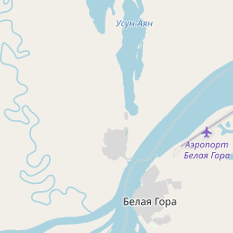
Abyysky District (Russian: Абы́йский улу́с; Yakut: Абый улууһа, Abıy uluuha, Yakut pronunciation: [abɯj uluːha]) is an administrative and municipal district (raion, or ulus), one of the thirty-four in the Sakha Republic, Russia. It is located in the north of the republic around the Indigirka River and borders with Allaikhovsky District in the north, Srednekolymsky District in the east, Verkhnekolymsky District in the southeast, Momsky District in the south, and with Ust-Yansky District in the west.
Nº Q480278 ★★
Poco común · Lugares
Abyysky District
Human settlement in Russia
Abyysky District (Russian: Абы́йский улу́с; Yakut: Абый улууһа, Abıy uluuha, Yakut pronunciation: [abɯj uluːha]) is an administrative and municipal district (raion, or ulus), one of the thirty-four in the Sakha Republic, Russia. It is located in the north of the republic around the Indigirka River and borders with Allaikhovsky District in the north, Srednekolymsky District in the east, Verkhnekolymsky District in the southeast, Momsky District in the south, and with Ust-Yansky District in the west.
En el mapa

Último precio
—
Precio mínimo
—
Mediana 7 d
—
Ventas 30 d
0
Rango 30 d
—
En circulación
0
Cotización
mediana
mín – máx
ventas
Sin ventas en el periodo
Ver tabla
| Fecha | mediana | Mín | Máx | ventas |
|---|
Historial de ventas
- Última venta
- —
- Media 30 d
- —
- Mínimo 30 d
- —
- Máximo 30 d
- —
- Ventas 7 d
- 0
- Ventas 30 d
- 0
Aún no hay ventas.
Ventas anónimas: sin comprador ni vendedor. Las cifras solo cuentan ventas entre jugadores.
En Wikipedia
Texto en inglés Aún no hay artículo en tu idioma: extracto en inglés.
Abyysky District (Russian: Абы́йский улу́с; Yakut: Абый улууһа, Abıy uluuha, Yakut pronunciation: [abɯj uluːha]) is an administrative and municipal district (raion, or ulus), one of the thirty-four in the Sakha Republic, Russia. It is located in the north of the republic around the Indigirka River and borders with Allaikhovsky District in the north, Srednekolymsky District in the east, Verkhnekolymsky District in the southeast, Momsky District in the south, and with Ust-Yansky District in the west. The area of the district is 69,400 square kilometers (26,800 sq mi). Its administrative center is the urban locality (an urban-type settlement) of Belaya Gora. As of the 2010 Census, the total population of the district was 4,425, with the population of Belaya Gora accounting for 50.7% of that number.
Texto: Wikipedia en inglés, CC BY-SA 4.0. · Imagen: Виктор Габышев (CC BY-SA 4.0) ·
Cartas cercanas

Ust-Yansky District
Municipal district in Russia
Nº Q1194681 ★★
Olenyoksky District
Municipal district in Russia
Nº Q1073180 ★★

Abazinsky District
Municipal district in Russia
Nº Q479354 ★★
Nyurbinsky District
District of the Sakha Republic, Russia
Nº Q639808 ★★

Churapchinsky District
Municipal district in Russia
Nº Q375163 ★★

Neryungrinsky District
Municipal district in Russia
Nº Q857552 ★★