


Hai River
River in the People's Republic of China
The Hai River (海河, lit. "Sea River"), also known as the Peiho, Pei Ho ("White River"), or Hai Ho, is a Chinese river in Tianjin emptying into the Bohai Sea. Its drainage basin covers most of Hebei, Beijing, and Tianjin, as well as parts of Inner Mongolia, Shanxi, Henan, and Shandong.
Nº Q501253 ★
Common · Places
Hai River
River in the People's Republic of China
The Hai River (海河, lit. "Sea River"), also known as the Peiho, Pei Ho ("White River"), or Hai Ho, is a Chinese river in Tianjin emptying into the Bohai Sea. Its drainage basin covers most of Hebei, Beijing, and Tianjin, as well as parts of Inner Mongolia, Shanxi, Henan, and Shandong.
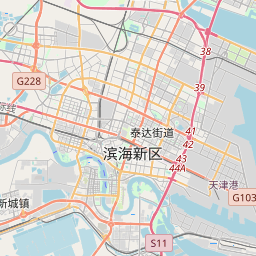
On the map
Last price
—
Floor price
—
7-day median
—
30-day sales
0
30-day range
—
In circulation
0
Price history
median
low – high
sales
No sales in this period
Show table
| Date | median | Low | High | sales |
|---|
Sales history
- Last sale
- —
- 30-day average
- —
- 30-day low
- —
- 30-day high
- —
- Sales 7d
- 0
- Sales 30d
- 0
No sales yet.
Anonymous sales: no buyer or seller shown. Figures count player-to-player sales only.
From Wikipedia
The Hai River (海河, lit. "Sea River"), also known as the Peiho, Pei Ho ("White River"), or Hai Ho, is a Chinese river in Tianjin emptying into the Bohai Sea. Its drainage basin covers most of Hebei, Beijing, and Tianjin, as well as parts of Inner Mongolia, Shanxi, Henan, and Shandong. The Hai River at is formed by the confluence of five watercourses: the Ziya River, Northern Canal, Southern Canal, Daqing River, and Yongding River. Both canals are part of the Grand Canal, the Northern Canal being the northern terminus of the Beijing-Hangzhou system connects with the Chaobai River, also called Bai He, at Tongzhou. It is the only waterway from the sea to the center of Beijing, therefore its names are sometimes used interchangeably. The Southern Canal is fed by the Wei River at Linqing. Via the Grand Canal, the Hai River is connected to the Yellow and Yangtze rivers. The construction of the Grand Canal greatly altered the rivers of the Hai River basin. Previously, the Wei, Ziya, Yongding, and Bai Rivers flowed independently of each other into the sea. The Grand Canal cut through the lower reaches of these rivers and fused them into one outlet in the form of the current Hai River. During the Song dynasty, the Hai River was considered the lower section of the Jie River (界河, lit. "Border River"). In the Jin and Yuan dynasties, it was named as Zhígū River (直沽河, lit. "Straight Gu River") and Dàgū River (大沽河, lit. “Great Gu River") respectively. The name Hai River first appeared towards the end of the Ming dynasty. The Hai River is 1,329 kilometers (826 mi) long as measured from the longest tributary, or 70 kilometers (43 mi) from the confluence of the Ziya River and Northern Canal to its estuary. Its...
Text: Wikipédia, CC BY-SA 4.0. · Image: Photo taken by Fanghong (CC BY-SA 3.0) ·
Related cards
-

Hutuo River
River in People's Republic of China
Nº Q6134426 ★★
Not listed
-

Bohai Bay
Part of gulf of the Yellow Sea, in northeast China
Nº Q495341 ★
Not listed
-

Ying River
River in People's Republic of China
Nº Q2341287 ★★
Not listed
-

Yongding River
River in the People's Republic of China
Nº Q1151727 ★
Not listed
-

Hailan River
Watercourse in People's Republic of China
Nº Q7222586 ★★★
Not listed
-

Nankai, Tianjin
District of China
Nº Q708155 ★★
Not listed