
Hebron Hills
Hills in the West Bank
The Hebron Hills, also known as Mount Hebron (Arabic: جبل الخليل, romanized: Jabal al-Khalīl; Hebrew: הר חברון, romanized: Har Khevron), are a mountain ridge, geographic region, and geologic formation, constituting the southern part of the Judean Mountains. They are located in the southern West Bank, Palestine.
Nº Q2917083 ★★
Uncommon · Places
Hebron Hills
Hills in the West Bank
The Hebron Hills, also known as Mount Hebron (Arabic: جبل الخليل, romanized: Jabal al-Khalīl; Hebrew: הר חברון, romanized: Har Khevron), are a mountain ridge, geographic region, and geologic formation, constituting the southern part of the Judean Mountains. They are located in the southern West Bank, Palestine.
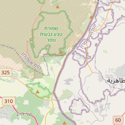
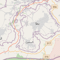
On the map
Last price
—
Floor price
—
7-day median
—
30-day sales
0
30-day range
—
In circulation
0
Price history
median
low – high
sales
No sales in this period
Show table
| Date | median | Low | High | sales |
|---|
Sales history
- Last sale
- —
- 30-day average
- —
- 30-day low
- —
- 30-day high
- —
- Sales 7d
- 0
- Sales 30d
- 0
No sales yet.
Anonymous sales: no buyer or seller shown. Figures count player-to-player sales only.
From Wikipedia
The Hebron Hills, also known as Mount Hebron (Arabic: جبل الخليل, romanized: Jabal al-Khalīl; Hebrew: הר חברון, romanized: Har Khevron), are a mountain ridge, geographic region, and geologic formation, constituting the southern part of the Judean Mountains. They are located in the southern West Bank, Palestine. During the Iron Age, the Hebron Hills were part of the Kingdom of Judah, which underwent a forced exile after being conquered by the Babylonians. Subsequently, in the Hellenistic period, an Edomite population migrating to the area became dominant, leading to its being referred to as Idumaea. The Edomites later converted to Judaism and assimilated into the Jewish population. Despite many settlements being destroyed or abandoned due to the brutal suppression of the Bar Kokhva revolt, a Jewish presence persisted in the area. In the Late Roman and Byzantine periods, the Hebron Hills were divided demographically into a Christian northern part and a mixed Jewish-Christian southern area. During this time, the southern Hebron Hills became known as Daroma, meaning "South" in Hebrew and Aramaic. Several synagogues from this period have been unearthed in the region. Following the Muslim conquest of the Levant, the Jewish population in the area declined as Muslims became dominant. In the Ottoman period, Mount Hebron served as a stop for farmers and herders, primarily from the deserts of Arabia and Transjordan, who migrated due to factors like severe drought. Between the 17th and 19th centuries, Mount Hebron experienced extensive violence involving rival families and Bedouins, leading to migrations and the destruction of many villages.
Text: Wikipédia, CC BY-SA 4.0. · Image: Trocaire from Ireland (CC BY 2.0) ·
Related cards

Herodium
Mountain in the West Bank
Nº Q913099 ★★

Judaean Desert
Desert in the southern Levant
Nº Q2046004 ★★

Susya
Ancient city near Mount Hebron, Judea, or Al Khalil Mountains
Nº Q248002 ★★★★

Gezer
Archaeological site in the foothills of the Judaean Mountains
Nº Q1466687 ★★

Mount Ebal site
Archaeological site in the West Bank
Nº Q12408984 ★

Otniel
Israeli settlement in the occupied West Bank
Nº Q2889568 ★★★★