
Kern River
River in California, United States
The Kern River is an Endangered, Wild and Scenic river in the U.S. state of California, approximately 165 miles (270 km) long. It drains an area of the southern Sierra Nevada mountains northeast of Bakersfield.
Nº Q1126662 ★★
Uncommon · Places
Kern River
River in California, United States
The Kern River is an Endangered, Wild and Scenic river in the U.S. state of California, approximately 165 miles (270 km) long. It drains an area of the southern Sierra Nevada mountains northeast of Bakersfield.
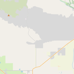
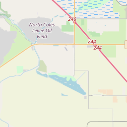
On the map
Last price
—
Floor price
—
7-day median
—
30-day sales
0
30-day range
—
In circulation
0
Price history
median
low – high
sales
No sales in this period
Show table
| Date | median | Low | High | sales |
|---|
Sales history
- Last sale
- —
- 30-day average
- —
- 30-day low
- —
- 30-day high
- —
- Sales 7d
- 0
- Sales 30d
- 0
No sales yet.
Anonymous sales: no buyer or seller shown. Figures count player-to-player sales only.
From Wikipedia
The Kern River is an Endangered, Wild and Scenic river in the U.S. state of California, approximately 165 miles (270 km) long. It drains an area of the southern Sierra Nevada mountains northeast of Bakersfield. Fed by snowmelt near Mount Whitney, the river passes through scenic canyons in the mountains and is a popular destination for whitewater rafting and kayaking. It is the southernmost major river system in the Sierra Nevada, and is the only major river in the Sierra that drains in a southerly direction. The Kern River formerly emptied into the now dry Buena Vista Lake and Kern Lake via the Kern River Slough, and Kern Lake in turn emptied into Buena Vista Lake via the Connecting Slough at the southern end of the Central Valley. Buena Vista Lake, when overflowing, first backed up into Kern Lake and then upon rising higher drained into Tulare Lake via Buena Vista Slough and a changing series of sloughs of the Kern River. The lakes were part of a partially endorheic basin that sometimes overflowed into the San Joaquin River. This basin also included the Kaweah and Tule Rivers, as well as southern distributaries of the Kings River that all flowed into Tulare Lake. Since the late 19th century the Kern has been almost entirely diverted for irrigation, recharging aquifers, and the California Aqueduct, although some water empties into Lake Webb and Lake Evans, two small lakes in a portion of the former Buena Vista lakebed. The lakes were created in 1973 for recreational use. The lakes hold 6,800 acre⋅ft (8,400 dam3) combined. Crops are grown in the rest of the former lakebed. In extremely wet years the river will reach the Tulare Lake basin through a series of sloughs and flood channels. Despite its remote source, nearly all of the...
Text: Wikipédia, CC BY-SA 4.0. · Image: Roger Howard (talk · contribs), , more images at http://www.... (CC BY-SA 2.5) ·
Related cards

Sacramento River
River in Northern and Central California, United States
Nº Q335575 ★★

San Joaquin River
River in California, United States
Nº Q751347 ★

Kern County, California
County in California, United States
Nº Q108047 ★★★

American River
River in California, United States
Nº Q466699 ★

Colorado River
Major river in the western United States and Mexico
Nº Q1265 ★★★★

Santa Ana River
River in San Bernardino, Riverside, and Orange counties in California, United States
Nº Q1761189 ★