
San Joaquin River
River in California, United States
The San Joaquin River ( SAN whah-KEEN; Spanish: Río San Joaquín [ˈri.o saŋ xoaˈkin]) is the longest river of Central California. The 366-mile (589 km) long river starts in the high Sierra Nevada and flows through the rich agricultural region of the northern San Joaquin Valley before reaching Suisun Bay, San Francisco Bay, and the Pacific Ocean.
Nº Q751347 ★
Common · Places
San Joaquin River
River in California, United States
The San Joaquin River ( SAN whah-KEEN; Spanish: Río San Joaquín [ˈri.o saŋ xoaˈkin]) is the longest river of Central California. The 366-mile (589 km) long river starts in the high Sierra Nevada and flows through the rich agricultural region of the northern San Joaquin Valley before reaching Suisun Bay, San Francisco Bay, and the Pacific Ocean.
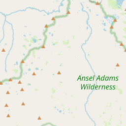
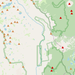
On the map
Last price
—
Floor price
—
7-day median
—
30-day sales
0
30-day range
—
In circulation
0
Price history
median
low – high
sales
No sales in this period
Show table
| Date | median | Low | High | sales |
|---|
Sales history
- Last sale
- —
- 30-day average
- —
- 30-day low
- —
- 30-day high
- —
- Sales 7d
- 0
- Sales 30d
- 0
No sales yet.
Anonymous sales: no buyer or seller shown. Figures count player-to-player sales only.
From Wikipedia
The San Joaquin River ( SAN whah-KEEN; Spanish: Río San Joaquín [ˈri.o saŋ xoaˈkin]) is the longest river of Central California. The 366-mile (589 km) long river starts in the high Sierra Nevada and flows through the rich agricultural region of the northern San Joaquin Valley before reaching Suisun Bay, San Francisco Bay, and the Pacific Ocean. An important source of irrigation water as well as a wildlife corridor, the San Joaquin is among the most heavily dammed and diverted of California's rivers. People have inhabited the San Joaquin Valley for more than 8,000 years, and it was one of the major population centers of pre-Columbian California. Starting in the late 18th century, successive waves of explorers then settlers, mainly Spanish and American, emigrated to the San Joaquin basin. When Spain colonized the area, they sent soldiers from Mexico, who were usually of mixed native Mexican and Spanish birth, led by Spanish officers. Franciscan missionaries from Spain came with expeditions to evangelize the natives by teaching them about the Catholic faith. Once an inland sea, most of the San Joaquin Valley has a very uniform topography, and much of the lower river formed a huge flood basin. In the 20th century, many levees and dams were built on the San Joaquin and all of its major tributaries. These engineering works changed the fluctuating nature of the river forever and cut off the Tulare Basin from the rest of the San Joaquin watershed. Once a habitat for hundreds of thousands of spawning salmon and millions of migratory birds, today the river is subject to tremendous water supply, navigation, and regulation works by various federal agencies, which have dramatically reduced the flow of the river since the 20th century.
Text: Wikipédia, CC BY-SA 4.0. · Image: MCalamari (Public domain) ·
Related cards

Sacramento River
River in Northern and Central California, United States
Nº Q335575 ★★

Stanislaus River
River in California, United States
Nº Q2331044 ★

San Joaquin Valley
Southern part of the Central Valley in California, United States
Nº Q964198 ★★★

Sacramento–San Joaquin River Delta
Inland river delta and estuary in Northern California
Nº Q1536323 ★★

Kern River
River in California, United States
Nº Q1126662 ★★

Sacramento Valley
Northern part of the Central Valley in California, United States
Nº Q1686914 ★