
Kozhikode district
District of Kerala, India
Kozhikode district (pronounced [koːɻikːoːɖɨ̆] ), is one of the 14 districts in the Indian state of Kerala, along its southwestern Malabar Coast. The city of Kozhikode, also known as Calicut, is the district headquarters.
Nº Q1142979 ★
Common · Places
Kozhikode district
District of Kerala, India
Kozhikode district (pronounced [koːɻikːoːɖɨ̆] ), is one of the 14 districts in the Indian state of Kerala, along its southwestern Malabar Coast. The city of Kozhikode, also known as Calicut, is the district headquarters.
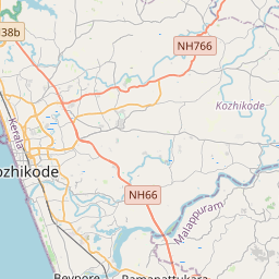
On the map
Last price
—
Floor price
—
7-day median
—
30-day sales
0
30-day range
—
In circulation
0
Price history
median
low – high
sales
No sales in this period
Show table
| Date | median | Low | High | sales |
|---|
Sales history
- Last sale
- —
- 30-day average
- —
- 30-day low
- —
- 30-day high
- —
- Sales 7d
- 0
- Sales 30d
- 0
No sales yet.
Anonymous sales: no buyer or seller shown. Figures count player-to-player sales only.
From Wikipedia
Kozhikode district (pronounced [koːɻikːoːɖɨ̆] ), is one of the 14 districts in the Indian state of Kerala, along its southwestern Malabar Coast. The city of Kozhikode, also known as Calicut, is the district headquarters. The Kozhikode Municipal Corporation has a corporation limit population of 609,224 and a metropolitan population of more than 2 million, making Kozhikode metropolitan area the second-largest in Kerala and the 19th largest in India. Kozhikode is classified as a Tier 2 city by the Government of India. NIT Calicut, NIEIT and IIM Kozhikode are institutions of national importance located in the district. Kozhikode is the largest city in the erstwhile Malabar District and acted as its headquarters during British Raj. In antiquity and the medieval period, Kozhikode was dubbed the City of Spices for its role as the major trading point for Indian spices. It was the capital of an independent kingdom ruled by the Samoothiris (Zamorins), which was also the largest kingdom in Kerala prior to the expansion of Travancore in the mid-18th century CE. The port at Kozhikode acted as the gateway to medieval South Indian coast for the Chinese, the Arabs, the Portuguese, the Dutch and finally the British. Kozhikode district is bordered by the districts of Kannur and Mahé (Puducherry) to the north, Wayanad to the east, and Malappuram to the south. The Arabian Sea lies to the west and the Western Ghats mountain range stretches towards the east. Vavul Mala, a 2,339 m high peak situated on the trijunction of Kozhikode, Malappuram, and Wayanad districts, is the highest point of elevation in the district. It lies between latitudes 11° 08'N and 11° 50'N and longitudes 75° 30'E and 76° 8'E. The Thamarassery Churam connects the city of Kozhikode with the plateau of Wayanad. The district is divided into four taluks: Kozhikode,...
Text: Wikipédia, CC BY-SA 4.0. · Image: Prof tpms (CC BY-SA 4.0) ·
Related cards

Kozhikode
City in Kerala, India
Nº Q28729 ★★★

Malabar District
Administrative district of British India
Nº Q239462 ★★

Palakkad district
District in Kerala, India
Nº Q1535742 ★

Kannur district
District of Kerala, India
Nº Q2980652 ★

Ernakulam district
District of Kerala, India
Nº Q1356097 ★★

Malappuram district
District of Kerala, India
Nº Q1030918 ★★