
Leicestershire
Ceremonial county in England
Leicestershire ( LEST-ər-sheer, -shər) is a ceremonial county in the East Midlands of England. It is bordered by Derbyshire, Nottinghamshire and Lincolnshire to the north, Rutland to the east, Northamptonshire to the south-east, Warwickshire to the south-west, and Staffordshire to the west.
Nº Q23106 ★★★
Rare · Places
Leicestershire
Ceremonial county in England
Leicestershire ( LEST-ər-sheer, -shər) is a ceremonial county in the East Midlands of England. It is bordered by Derbyshire, Nottinghamshire and Lincolnshire to the north, Rutland to the east, Northamptonshire to the south-east, Warwickshire to the south-west, and Staffordshire to the west.
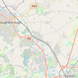
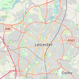
On the map


Last price
—
Floor price
—
7-day median
—
30-day sales
0
30-day range
—
In circulation
0
Price history
median
low – high
sales
No sales in this period
Show table
| Date | median | Low | High | sales |
|---|
Sales history
- Last sale
- —
- 30-day average
- —
- 30-day low
- —
- 30-day high
- —
- Sales 7d
- 0
- Sales 30d
- 0
No sales yet.
Anonymous sales: no buyer or seller shown. Figures count player-to-player sales only.
From Wikipedia
Leicestershire ( LEST-ər-sheer, -shər) is a ceremonial county in the East Midlands of England. It is bordered by Derbyshire, Nottinghamshire and Lincolnshire to the north, Rutland to the east, Northamptonshire to the south-east, Warwickshire to the south-west, and Staffordshire to the west. The city of Leicester is the largest settlement. The county has an area of 2,156 km2 (832 sq mi) and an estimated population of 1,133,921 in 2024. Leicester is in the centre of the county and is by far the largest settlement; its urban area includes the towns of Wigston and Oadby immediately to the south-east. The rest of the county is largely rural, and its settlements include the university town of Loughborough in the north, Melton Mowbray in the north-east, Hinckley in the south-west, Market Harborough in the south-east, and Coalville in the north-west. For local government purposes Leicestershire comprises a non-metropolitan county, with seven districts, and the unitary authority area of Leicester. Leicestershire is generally a lowland county, characterised by small, rolling hills. It is bisected by the River Soar, which rises near the Warwickshire border south of Hinckley and flows north through Leicester and Loughborough before reaching the Trent at the county boundary. To the west of the river is Charnwood Forest, an upland area which contains Bardon Hill, which at 278 m (912 ft) is the county's highest point. There are prehistoric earthworks in the county, and Leicester was a Roman settlement. The region was settled by the Angles in the sixth century and became part of the Kingdom of Mercia, and the county existed at the time of the Domesday Survey in the 1080s. The county has had a relatively settled existence; however, it was the site of the Battle of Bosworth Field in 1485, which established the Tudor dynasty's position as monarchs...
Text: Wikipédia, CC BY-SA 4.0. · Image: Own work (CC BY-SA 3.0) ·
Related cards

Northamptonshire
Ceremonial county in England, UK
Nº Q23115 ★★★

Nottinghamshire
Ceremonial county of England
Nº Q23092 ★★★

Warwickshire
Ceremonial and non-metropolitan county in England, UK
Nº Q23140 ★★★

Lincolnshire
Ceremonial county in the east of England
Nº Q23090 ★★★

Staffordshire
Ceremonial county in England
Nº Q23105 ★★★

Midlands
Area comprising central England
Nº Q850235 ★★★