
Northamptonshire
Ceremonial county in England, UK
Northamptonshire ( nor-THAMP-tən-shər, -sheer; abbreviated Northants.) is a ceremonial county in the East Midlands of England. It is bordered by Leicestershire, Rutland and Lincolnshire to the north; Cambridgeshire to the east; Bedfordshire and Buckinghamshire to the south; Oxfordshire to the south west; and Warwickshire to the west.
Nº Q23115 ★★★
Rare · Places
Northamptonshire
Ceremonial county in England, UK
Northamptonshire ( nor-THAMP-tən-shər, -sheer; abbreviated Northants.) is a ceremonial county in the East Midlands of England. It is bordered by Leicestershire, Rutland and Lincolnshire to the north; Cambridgeshire to the east; Bedfordshire and Buckinghamshire to the south; Oxfordshire to the south west; and Warwickshire to the west.
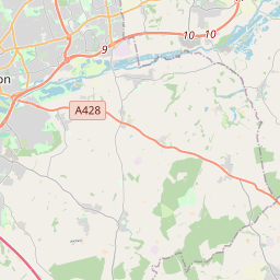
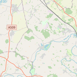
On the map
Last price
—
Floor price
—
7-day median
—
30-day sales
0
30-day range
—
In circulation
0
Price history
median
low – high
sales
No sales in this period
Show table
| Date | median | Low | High | sales |
|---|
Sales history
- Last sale
- —
- 30-day average
- —
- 30-day low
- —
- 30-day high
- —
- Sales 7d
- 0
- Sales 30d
- 0
No sales yet.
Anonymous sales: no buyer or seller shown. Figures count player-to-player sales only.
From Wikipedia
Northamptonshire ( nor-THAMP-tən-shər, -sheer; abbreviated Northants.) is a ceremonial county in the East Midlands of England. It is bordered by Leicestershire, Rutland and Lincolnshire to the north; Cambridgeshire to the east; Bedfordshire and Buckinghamshire to the south; Oxfordshire to the south west; and Warwickshire to the west. Northampton is the largest settlement. The county has an area of 2,364 km2 (913 sq mi) and had an estimated population of 813,682 in 2024. Northampton is in the centre of the county, and its other principal towns include Corby and Kettering in the north-east and Wellingborough in the centre. The east and south-west are rural. For local government purposes Northamptonshire comprises two unitary authority areas, North Northamptonshire and West Northamptonshire. The county historically included Peterborough and its surrounding area, called the Soke. The county is characterised by low, undulating hills, particularly to the west. They are the source of several rivers, including the Avon and Welland, which form much of the northern border; the Cherwell; and the Great Ouse. The River Nene is the principal river within the county, having its source in the southwest and flowing northeast past Northampton and Wellingborough. The highest point is Arbury Hill southwest of Daventry, at 225 m (738 ft). There are Iron Age and Roman remains in the county, and in the seventh century it was settled by the Angles and Saxons, becoming part of Mercia. The county likely has its origin in the Danelaw as the area controlled from Northampton, which was one of the Five Boroughs. In the later Middle Ages and Early Modern Period the county was relatively settled, although Northampton was the location of engagements, including the 1264 Battle of Northampton during the Second Barons' War, the 1460 Battle of Northampton during the Wars of the Roses, and the decisive Battle...
Text: Wikipédia, CC BY-SA 4.0. · Image: DeFacto (CC BY-SA 4.0) ·
Related cards

Nottinghamshire
Ceremonial county of England
Nº Q23092 ★★★

Leicestershire
Ceremonial county in England
Nº Q23106 ★★★

Lincolnshire
Ceremonial county in the east of England
Nº Q23090 ★★★

Bedfordshire
Ceremonial county of England
Nº Q23143 ★★★

Cambridgeshire
Ceremonial county of England, UK
Nº Q23112 ★★★

Northampton
Town and civil parish in Northamptonshire, England, UK
Nº Q192240 ★★★