
Nihonbashi River
River in Tokyo
The Nihonbashi River (日本橋川, Nihonbashi-gawa) is a river which flows through central Tokyo, Japan. It is a distributary river of the Kanda River and flows into the Sumida River near the Eitai Bridge. The river is 4.8 km (3.0 mi) in length and passes through Chiyoda and Chuo wards.
Nº Q6854971 ★★★
Rare · Places
Nihonbashi River
River in Tokyo
The Nihonbashi River (日本橋川, Nihonbashi-gawa) is a river which flows through central Tokyo, Japan. It is a distributary river of the Kanda River and flows into the Sumida River near the Eitai Bridge. The river is 4.8 km (3.0 mi) in length and passes through Chiyoda and Chuo wards.
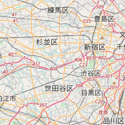
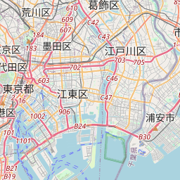
On the map
Last price
—
Floor price
—
7-day median
—
30-day sales
0
30-day range
—
In circulation
0
Price history
median
low – high
sales
No sales in this period
Show table
| Date | median | Low | High | sales |
|---|
Sales history
- Last sale
- —
- 30-day average
- —
- 30-day low
- —
- 30-day high
- —
- Sales 7d
- 0
- Sales 30d
- 0
No sales yet.
Anonymous sales: no buyer or seller shown. Figures count player-to-player sales only.
From Wikipedia
The Nihonbashi River (日本橋川, Nihonbashi-gawa) is a river which flows through central Tokyo, Japan. It is a distributary river of the Kanda River and flows into the Sumida River near the Eitai Bridge. The river is 4.8 km (3.0 mi) in length and passes through Chiyoda and Chuo wards. The river was created by a re-channeling of the former Hira River in the 15th century at the direction of Ōta Dōkan to form a part of the external fortifications and water management plan for Edo Castle. Connected to Tokyo Bay the river is shallow in depth and subject to a tidal range of up to two meters. The river banks are heavily built up in character and the Inner Circular Route C1 of the Shuto Expressway has covered almost the entire length of the river since the expressway's construction in 1962. Despite this the river features urban park space along its southern bank, occasional boat tours and a number of noteworthy and historic bridges along its route; foremost being the Nihonbashi Bridge designed by Tsumaki Yorinaka in 1911.
Text: Wikipédia, CC BY-SA 4.0. · Image: No machine-readable author provided. Fg2 assumed (based on c... (Public domain) ·
Related cards

Torrelles de Foix
Municipality of Spain
Nº Q984393 ★★★

Dalyan
Mahalle (administrative quarter) in Ortaca, Muğla, southwestern Turkey
Nº Q518586 ★★★

Saltivka
Residential area in Kharkiv, Ukraine
Nº Q7406153 ★★★

Old Man of the Mountain
Former rock formation on Cannon Mountain in Franconia, New Hampshire, United States (collapsed 2003)
Nº Q1508103 ★★★

Moab, Utah
City in and county seat of Grand County, Utah, United States
Nº Q130134 ★★★

Chellah
Medieval fortified necropolis located in the metro area of Rabat
Nº Q2314811 ★★★