
Ruvuma River
River in the African Great Lakes region
Ruvuma River, formerly also known as the Rovuma River, is a river in the African Great Lakes region. During the greater part of its course, it forms the border between Tanzania and Mozambique. The river is 998 km (620 mi) long, with a drainage basin of ~155,000 km2 (60,000 mi2) in size.
Nº Q746779 ★★
Uncommon · Places
Ruvuma River
River in the African Great Lakes region
Ruvuma River, formerly also known as the Rovuma River, is a river in the African Great Lakes region. During the greater part of its course, it forms the border between Tanzania and Mozambique. The river is 998 km (620 mi) long, with a drainage basin of ~155,000 km2 (60,000 mi2) in size.
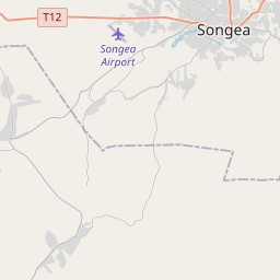
On the map
Last price
—
Floor price
—
7-day median
—
30-day sales
0
30-day range
—
In circulation
0
Price history
median
low – high
sales
No sales in this period
Show table
| Date | median | Low | High | sales |
|---|
Sales history
- Last sale
- —
- 30-day average
- —
- 30-day low
- —
- 30-day high
- —
- Sales 7d
- 0
- Sales 30d
- 0
No sales yet.
Anonymous sales: no buyer or seller shown. Figures count player-to-player sales only.
From Wikipedia
Ruvuma River, formerly also known as the Rovuma River, is a river in the African Great Lakes region. During the greater part of its course, it forms the border between Tanzania and Mozambique. The river is 998 km (620 mi) long, with a drainage basin of ~155,000 km2 (60,000 mi2) in size. Its mean annual discharge is 475 m3/s (16,800 cu ft/s) to 2,286 m3/s (80,700 cu ft/s) at its mouth.
Text: Wikipédia, CC BY-SA 4.0. · Image: David Livingstone (Public domain) ·
Related cards

Lualaba River
River in the eastern Democratic Republic of Congo
Nº Q836812 ★

Rufiji River
River in Tanzania
Nº Q936023 ★

Lúrio River
River of northeastern Mozambique
Nº Q11047093 ★★

Luangwa River
River in Zambia
Nº Q1321671 ★

Congo Basin
Basin of the Congo River in West Equatorial Africa
Nº Q932289 ★★★

Lake Kivu
Meromictic lake in the East African Rift valley
Nº Q125912 ★★★★