

Uncommon · Places
Tomponsky District
Municipal district in Russia
Tomponsky District (Russian: Томпонский улу́с; Yakut: Томпо улууһа, Tompo uluuha) is an administrative and municipal district (raion, or ulus), one of the thirty-four in the Sakha Republic, Russia. It is located in the east of the republic and borders with Momsky District in the northeast, Oymyakonsky District in the east, Ust-Maysky District in the southeast, Tattinsky District in the southwest, Ust-Aldansky and Kobyaysky Districts in the west, and with Verkhoyansky District in the north and northwest.
On the map
From Wikipedia
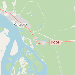
Tomponsky District (Russian: Томпонский улу́с; Yakut: Томпо улууһа, Tompo uluuha) is an administrative and municipal district (raion, or ulus), one of the thirty-four in the Sakha Republic, Russia. It is located in the east of the republic and borders with Momsky District in the northeast, Oymyakonsky District in the east, Ust-Maysky District in the southeast, Tattinsky District in the southwest, Ust-Aldansky and Kobyaysky Districts in the west, and with Verkhoyansky District in the north and northwest. The area of the district is 135,800 square kilometers (52,400 sq mi). Its administrative center is the urban locality (a settlement) of Khandyga. Population: 14,099 (2010 census); 15,275 (2002 Census); 22,844 (1989 Soviet census). The population of Khandyga accounts for 47.1% of the district's total population. The landscape of the district is mostly mountainous. Its main rivers include the Aldan, the Tompo, Adycha, Nelgese, Derbeke and the Khandyga. Emanda is a lake located on the Yana Plateau, in the northern part of the district. Average January temperature ranges from −38 to −42 °C (−36 to −44 °F) and average July temperature ranges from +10 to +17 °C (50 to 63 °F).
Text: Wikipédia, CC BY-SA 4.0. · Image: Dima myreev (CC BY-SA 4.0) ·