
Tomponsky District
Municipal district in Russia
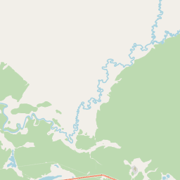
Tomponsky District (Russian: Томпонский улу́с; Yakut: Томпо улууһа, Tompo uluuha) is an administrative and municipal district (raion, or ulus), one of the thirty-four in the Sakha Republic, Russia. It is located in the east of the republic and borders with Momsky District in the northeast, Oymyakonsky District in the east, Ust-Maysky District in the southeast, Tattinsky District in the southwest, Ust-Aldansky and Kobyaysky Districts in the west, and with Verkhoyansky District in the north and northwest.
Nº Q1094037 ★★
Incomum · Lugares
Tomponsky District
Municipal district in Russia
Tomponsky District (Russian: Томпонский улу́с; Yakut: Томпо улууһа, Tompo uluuha) is an administrative and municipal district (raion, or ulus), one of the thirty-four in the Sakha Republic, Russia. It is located in the east of the republic and borders with Momsky District in the northeast, Oymyakonsky District in the east, Ust-Maysky District in the southeast, Tattinsky District in the southwest, Ust-Aldansky and Kobyaysky Districts in the west, and with Verkhoyansky District in the north and northwest.
No mapa
Último preço
—
Preço mínimo
—
Mediana 7 d
—
Vendas 30 d
0
Faixa 30 d
—
Em circulação
0
Cotação
mediana
mín – máx
vendas
Sem vendas no período
Ver tabela
| Data | mediana | Mín | Máx | vendas |
|---|
Histórico de vendas
- Última venda
- —
- Média 30 d
- —
- Mínima 30 d
- —
- Máxima 30 d
- —
- Vendas 7 d
- 0
- Vendas 30 d
- 0
Ainda sem vendas.
Vendas anônimas: sem comprador nem vendedor. Os números contam só vendas entre jogadores.
Na Wikipédia
Texto em inglês Ainda não há artigo no seu idioma: trecho em inglês.
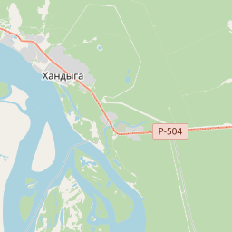
Tomponsky District (Russian: Томпонский улу́с; Yakut: Томпо улууһа, Tompo uluuha) is an administrative and municipal district (raion, or ulus), one of the thirty-four in the Sakha Republic, Russia. It is located in the east of the republic and borders with Momsky District in the northeast, Oymyakonsky District in the east, Ust-Maysky District in the southeast, Tattinsky District in the southwest, Ust-Aldansky and Kobyaysky Districts in the west, and with Verkhoyansky District in the north and northwest. The area of the district is 135,800 square kilometers (52,400 sq mi). Its administrative center is the urban locality (a settlement) of Khandyga. Population: 14,099 (2010 census); 15,275 (2002 Census); 22,844 (1989 Soviet census). The population of Khandyga accounts for 47.1% of the district's total population.
Texto: Wikipédia em inglês, CC BY-SA 4.0. · Imagem: Dima myreev (CC BY-SA 4.0) ·
Cartas próximas

Ust-Aldansky District
Municipal district in Russia
Nº Q1073189 ★★

Verkhoyansky District
Municipal district in Russia
Nº Q1094346 ★★

Ust-Maysky District
Municipal district in Russia
Nº Q1094018 ★★

Oymyakonsky District
Municipal district in Yakutia, Russia
Nº Q569987 ★★

Tattinsky District
Municipal district in Yakutia, Russia
Nº Q639819 ★★

Bulunsky District
Municipal district in Russia
Nº Q572266 ★★★