
Wayanad district
District of Kerala, India
Wayanad district (Malayalam: [ʋɐjɐnaːɖɨ̆]), or Wynad, is a district in the north-east of the Indian state of Kerala, with its administrative headquarters at the municipality of Kalpetta. It is the only plateau in Kerala.
Nº Q1364427 ★★
Uncommon · Places
Wayanad district
District of Kerala, India
Wayanad district (Malayalam: [ʋɐjɐnaːɖɨ̆]), or Wynad, is a district in the north-east of the Indian state of Kerala, with its administrative headquarters at the municipality of Kalpetta. It is the only plateau in Kerala.
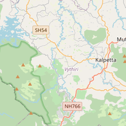
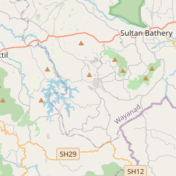
On the map
Last price
—
Floor price
—
7-day median
—
30-day sales
0
30-day range
—
In circulation
0
Price history
median
low – high
sales
No sales in this period
Show table
| Date | median | Low | High | sales |
|---|
Sales history
- Last sale
- —
- 30-day average
- —
- 30-day low
- —
- 30-day high
- —
- Sales 7d
- 0
- Sales 30d
- 0
No sales yet.
Anonymous sales: no buyer or seller shown. Figures count player-to-player sales only.
From Wikipedia
Wayanad district (Malayalam: [ʋɐjɐnaːɖɨ̆]), or Wynad, is a district in the north-east of the Indian state of Kerala, with its administrative headquarters at the municipality of Kalpetta. It is the only plateau in Kerala. The Wayanad Plateau forms a continuation of the Mysore Plateau, the southern portion of the Deccan Plateau. It is set high in the Western Ghats with altitudes ranging from 700 to 2,100 meters and some areas resemble to Eastern Ghats including Kolagapara, Kurumbalakotta and some parts of Vadakkanad and Chekadi. Vellari Mala, a 2,240 m (7,349 ft) high peak situated on the trijunction of Wayanad, Malappuram, and Kozhikode districts, is the highest point in Wayanad district. The district was formed on 1 November 1980 as the 12th district in Kerala, by carving out areas from Kozhikode and Kannur districts. An area of 885.92 km2 in the district is forested. Wayanad has three municipal towns—Kalpetta, Mananthavady and Sulthan Bathery. There are many indigenous tribes in this area. The Kabini River, a tributary of the Kaveri River, originates at Wayanad. Wayanad district, along with the Chaliyar valley in the neighbouring Nilambur (Eastern Eranad region) in Malappuram district, is known for natural gold fields, which are also seen in other parts of the Nilgiri Biosphere Reserve. The Chaliyar river, which is the fourth longest river of Kerala, originates on the Wayanad plateau. The historically important Edakkal Caves are located in Wayanad district. Wayanad district is bordered by Karnataka (Kodagu, Chamarajanagar and Mysore districts) to the north and north-east, Tamil Nadu (Nilgiris district) to the south-east (it is the only district that shares border with both the neighbouring states of Kerala), Malappuram to the south, Kozhikode to the south-west and Kannur to the north-west. Pulpally in Wayanad boasts the only Lava-Kusha temple in Kerala and Vythiri has the only mirror...
Text: Wikipédia, CC BY-SA 4.0. · Image: Nitin Pai from India (CC BY 2.0) ·
Related cards

Palakkad district
District in Kerala, India
Nº Q1535742 ★

Wayanad Lok Sabha constituency
Lok Sabha Constituency in Kerala
Nº Q7975848 ★★

Thrissur district
District of Kerala, India
Nº Q2429655 ★

Kuttanad
Region in Kerala, India
Nº Q1435109 ★★

Kannur district
District of Kerala, India
Nº Q2980652 ★

Palakkad
City in Kerala
Nº Q1006240 ★★