
Elm
Mountain range
The Elm (German pronunciation: [ɛlm] ) is a range of hills north of the Harz mountains in the Helmstedt and Wolfenbüttel districts of Lower Saxony, Germany. It has a length of about 25 km (16 mi) and a width of 3–8 km (1.9–5.0 mi) and rises to an elevation of 323 meters.
Nº Q896176 ★★★
Rara · Lugares
Elm
Mountain range
The Elm (German pronunciation: [ɛlm] ) is a range of hills north of the Harz mountains in the Helmstedt and Wolfenbüttel districts of Lower Saxony, Germany. It has a length of about 25 km (16 mi) and a width of 3–8 km (1.9–5.0 mi) and rises to an elevation of 323 meters.
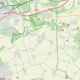
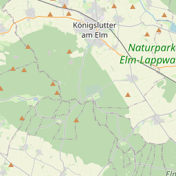
En el mapa
Último precio
—
Precio mínimo
—
Mediana 7 d
—
Ventas 30 d
0
Rango 30 d
—
En circulación
0
Cotización
mediana
mín – máx
ventas
Sin ventas en el periodo
Ver tabla
| Fecha | mediana | Mín | Máx | ventas |
|---|
Historial de ventas
- Última venta
- —
- Media 30 d
- —
- Mínimo 30 d
- —
- Máximo 30 d
- —
- Ventas 7 d
- 0
- Ventas 30 d
- 0
Aún no hay ventas.
Ventas anónimas: sin comprador ni vendedor. Las cifras solo cuentan ventas entre jugadores.
En Wikipedia
Texto en inglés Aún no hay artículo en tu idioma: extracto en inglés.
The Elm (German pronunciation: [ɛlm] ) is a range of hills north of the Harz mountains in the Helmstedt and Wolfenbüttel districts of Lower Saxony, Germany. It has a length of about 25 km (16 mi) and a width of 3–8 km (1.9–5.0 mi) and rises to an elevation of 323 meters. Surrounded by the Northern European Lowlands, the Elm is almost uninhabited and the largest beech forest in Northern Germany. The hills are of a triassic limestone called Elmkalkstein. Together with the neighbouring Lappwald range, the Elm has been a protected nature park since 1977. The Elm is a popular among hikers, cyclists, and motor cyclists. Rivers originating in the Elm include: Altenau Lutter Missaue Scheppau Schunter Wabe Towns on the edge of the Elm include: Königslutter Schöningen Schöppenstedt Elevations Eilumer Horn (323,3 m) Osterberg (c. 314 m) Drachenberg (c. 313 m) Burgberg (c. 311 m) Amplebener Berg (310 m) Kleiner Tafelberg (c. 302 m) Kiefelhorn (301 m) Großer Tafelberg (296 m) Warberg (290 m) Wolfsburger Kopf (289 m)
Texto: Wikipedia en inglés, CC BY-SA 4.0. · Imagen: ArtMechanic (CC BY-SA 3.0) ·
Cartas cercanas

Sint-Genesius-Rode
Municipio de Bélgica
Nº Q841597 ★★★

Amethi Lok Sabha constituency
Lok Sabha Constituency in Uttar Pradesh
Nº Q4745924 ★★★

Cidonia (Marte)
Región de Marte
Nº Q3699867 ★★★

Frontera entre Haití y la República Dominicana
Nº Q3088651 ★★★

Lamu (Kenia)
Nº Q272799 ★★★

Oak of Mamre
Venerated site in the West Bank
Nº Q2473173 ★★★