
Elm
Mountain range
The Elm (German pronunciation: [ɛlm] ) is a range of hills north of the Harz mountains in the Helmstedt and Wolfenbüttel districts of Lower Saxony, Germany. It has a length of about 25 km (16 mi) and a width of 3–8 km (1.9–5.0 mi) and rises to an elevation of 323 meters.
Nº Q896176 ★★★
Rara · Lugares
Elm
Mountain range
The Elm (German pronunciation: [ɛlm] ) is a range of hills north of the Harz mountains in the Helmstedt and Wolfenbüttel districts of Lower Saxony, Germany. It has a length of about 25 km (16 mi) and a width of 3–8 km (1.9–5.0 mi) and rises to an elevation of 323 meters.
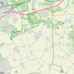
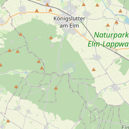
No mapa
Último preço
—
Preço mínimo
—
Mediana 7 d
—
Vendas 30 d
0
Faixa 30 d
—
Em circulação
0
Cotação
mediana
mín – máx
vendas
Sem vendas no período
Ver tabela
| Data | mediana | Mín | Máx | vendas |
|---|
Histórico de vendas
- Última venda
- —
- Média 30 d
- —
- Mínima 30 d
- —
- Máxima 30 d
- —
- Vendas 7 d
- 0
- Vendas 30 d
- 0
Ainda sem vendas.
Vendas anônimas: sem comprador nem vendedor. Os números contam só vendas entre jogadores.
Na Wikipédia
Texto em inglês Ainda não há artigo no seu idioma: trecho em inglês.
The Elm (German pronunciation: [ɛlm] ) is a range of hills north of the Harz mountains in the Helmstedt and Wolfenbüttel districts of Lower Saxony, Germany. It has a length of about 25 km (16 mi) and a width of 3–8 km (1.9–5.0 mi) and rises to an elevation of 323 meters. Surrounded by the Northern European Lowlands, the Elm is almost uninhabited and the largest beech forest in Northern Germany. The hills are of a triassic limestone called Elmkalkstein. Together with the neighbouring Lappwald range, the Elm has been a protected nature park since 1977. The Elm is a popular among hikers, cyclists, and motor cyclists. Rivers originating in the Elm include: Altenau Lutter Missaue Scheppau Schunter Wabe Towns on the edge of the Elm include: Königslutter Schöningen Schöppenstedt Elevations Eilumer Horn (323,3 m) Osterberg (c. 314 m) Drachenberg (c. 313 m) Burgberg (c. 311 m) Amplebener Berg (310 m) Kleiner Tafelberg (c. 302 m) Kiefelhorn (301 m) Großer Tafelberg (296 m) Warberg (290 m) Wolfsburger Kopf (289 m)
Texto: Wikipédia em inglês, CC BY-SA 4.0. · Imagem: ArtMechanic (CC BY-SA 3.0) ·


