
Schneifel
Mountain range
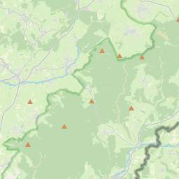
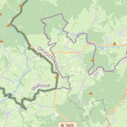
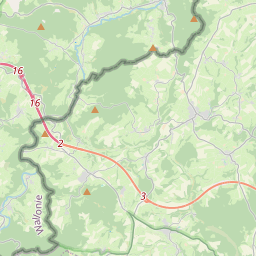
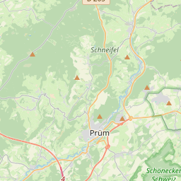
The Schneifel is a range of low mountains, up to 699.1 m above sea level (NHN), in the western part of the Eifel in Germany, near the Belgian border. It runs from Brandscheid near Prüm in a northeasterly direction to Ormont. The name Schneifel has nothing to do with the German words Schnee (snow) and Eifel.
Nº Q896002 ★★
Poco común · Lugares
Schneifel
Mountain range
The Schneifel is a range of low mountains, up to 699.1 m above sea level (NHN), in the western part of the Eifel in Germany, near the Belgian border. It runs from Brandscheid near Prüm in a northeasterly direction to Ormont. The name Schneifel has nothing to do with the German words Schnee (snow) and Eifel.
En el mapa
Último precio
—
Precio mínimo
—
Mediana 7 d
—
Ventas 30 d
0
Rango 30 d
—
En circulación
0
Cotización
mediana
mín – máx
ventas
Sin ventas en el periodo
Ver tabla
| Fecha | mediana | Mín | Máx | ventas |
|---|
Historial de ventas
- Última venta
- —
- Media 30 d
- —
- Mínimo 30 d
- —
- Máximo 30 d
- —
- Ventas 7 d
- 0
- Ventas 30 d
- 0
Aún no hay ventas.
Ventas anónimas: sin comprador ni vendedor. Las cifras solo cuentan ventas entre jugadores.
En Wikipedia
Texto en inglés Aún no hay artículo en tu idioma: extracto en inglés.
The Schneifel is a range of low mountains, up to 699.1 m above sea level (NHN), in the western part of the Eifel in Germany, near the Belgian border. It runs from Brandscheid near Prüm in a northeasterly direction to Ormont. The name Schneifel has nothing to do with the German words Schnee (snow) and Eifel. It is derived from the former dialect of this region and means something like Schneise ("swathe"). This swathe ran over the mountains. The term was "Germanised" during the Prussian era and the term Schnee-Eifel ("Snow Eifel") was born, albeit referring to a larger area. Winters in this low mountainous region are unusually cold and snowy for western and parts of central Europe and snow lies here for longer than anywhere else in the Eifel. As a result, the winter sports season is longer here than in the surrounding region. The highest point of the Schneifel is the 699.1-metre-high Schwarze Mann ("Black Man"), which is also the third highest point of the Eifel range after the Hohe Acht and the Erresberg (Ernstberg). There is a winter sports area on the Schwarze Mann with the same name. The Schneifel is covered along its entire length by the ruins of bunkers which formed part of the Siegfried Line. On the heights of the Schneifel is the former US radar station, Prüm Air Station, and the Schnee Eifel transmission tower for terrestrial TV and VHF which, with a height of 224 m is clearly visible for miles.
Texto: Wikipedia en inglés, CC BY-SA 4.0. · Imagen: Mabol! (CC BY-SA 3.0) ·
Cartas cercanas
-

Schnee Eifel
Landscape
Nº Q896245 ★
Sin ofertas
-
S
South Eifel
Part of the Eifel mountain region around the Bitburg-Prüm district in the German state of Rhineland-Palatinate
Nº Q2380693 ★★
Sin ofertas
-
N
North Eifel
Northern part of the Eifel in North Rhine-Westphalia, Germany
Nº Q1997843 ★★
Sin ofertas
-
S
Sieben Berge
Mountains in Germany
Nº Q1664835 ★★
Sin ofertas
-

High Fens – Eifel Nature Park
Nature park in Germany and Belgium
Nº Q317524 ★★★★
Sin ofertas
-

Schneeberg (Fichtel Mountains)
Highest mountain of the Fichtel Mountains in Bavaria, Germany
Nº Q314166 ★★★
Sin ofertas