
Schneifel
Chaîne de montagnes allemande
The Schneifel is a range of low mountains, up to 699.1 m above sea level (NHN), in the western part of the Eifel in Germany, near the Belgian border. It runs from Brandscheid near Prüm in a northeasterly direction to Ormont. The name Schneifel has nothing to do with the German words Schnee (snow) and Eifel.
Nº Q896002 ★★
Peu commune · Lieux
Schneifel
Chaîne de montagnes allemande
The Schneifel is a range of low mountains, up to 699.1 m above sea level (NHN), in the western part of the Eifel in Germany, near the Belgian border. It runs from Brandscheid near Prüm in a northeasterly direction to Ormont. The name Schneifel has nothing to do with the German words Schnee (snow) and Eifel.
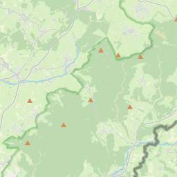
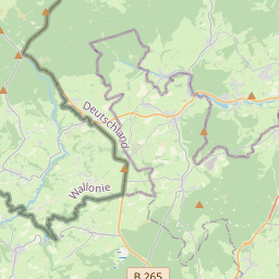
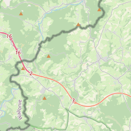
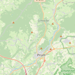
Sur la carte
Dernier prix
—
Prix plancher
—
Médiane 7 j
—
Ventes 30 j
0
Fourchette 30 j
—
En circulation
0
Cours
médiane
min – max
ventes
Aucune vente sur la période
Voir le tableau
| Date | médiane | Min | Max | ventes |
|---|
Historique des ventes
- Dernière vente
- —
- Moyenne 30 j
- —
- Plus bas 30 j
- —
- Plus haut 30 j
- —
- Ventes 7 j
- 0
- Ventes 30 j
- 0
Aucune vente pour l'instant.
Ventes anonymes : ni acheteur ni vendeur. Les chiffres ne comptent que les ventes entre joueurs.
Sur Wikipédia
Texte en anglais Pas encore d'article dans ta langue : extrait en anglais.
The Schneifel is a range of low mountains, up to 699.1 m above sea level (NHN), in the western part of the Eifel in Germany, near the Belgian border. It runs from Brandscheid near Prüm in a northeasterly direction to Ormont. The name Schneifel has nothing to do with the German words Schnee (snow) and Eifel. It is derived from the former dialect of this region and means something like Schneise ("swathe"). This swathe ran over the mountains. The term was "Germanised" during the Prussian era and the term Schnee-Eifel ("Snow Eifel") was born, albeit referring to a larger area. Winters in this low mountainous region are unusually cold and snowy for western and parts of central Europe and snow lies here for longer than anywhere else in the Eifel. As a result, the winter sports season is longer here than in the surrounding region. The highest point of the Schneifel is the 699.1-metre-high Schwarze Mann ("Black Man"), which is also the third highest point of the Eifel range after the Hohe Acht and the Erresberg (Ernstberg). There is a winter sports area on the Schwarze Mann with the same name. The Schneifel is covered along its entire length by the ruins of bunkers which formed part of the Siegfried Line. On the heights of the Schneifel is the former US radar station, Prüm Air Station, and the Schnee Eifel transmission tower for terrestrial TV and VHF which, with a height of 224 m is clearly visible for miles.
Texte : Wikipédia en anglais, CC BY-SA 4.0. · Image : Mabol! (CC BY-SA 3.0) ·
Cartes voisines
-

Schnee Eifel
Landscape
Nº Q896245 ★
Pas en vente
-
S
South Eifel
Part of the Eifel mountain region around the Bitburg-Prüm district in the German state of Rhineland-Palatinate
Nº Q2380693 ★★
Pas en vente
-
N
North Eifel
Northern part of the Eifel in North Rhine-Westphalia, Germany
Nº Q1997843 ★★
Pas en vente
-
S
Sieben Berge
Mountains in Germany
Nº Q1664835 ★★
Pas en vente
-

Parc naturel des Hautes Fagnes–Eifel
Aire protégée d'Allemagne et de Belgique
Nº Q317524 ★★★★
Pas en vente
-

Schneeberg (Fichtel Mountains)
Highest mountain of the Fichtel Mountains in Bavaria, Germany
Nº Q314166 ★★★
Pas en vente