Baarin
Village in Syria
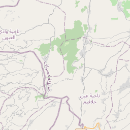
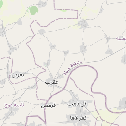
Baarin (Arabic: بعرين, Baʿrīn or Biʿrīn) is a village in northern Syria, administratively part of the Hama Governorate, located in Homs Gap roughly 38 kilometers (24 mi) southwest of Hama. Nearby localities include Taunah and Awj to the south, Aqrab and Houla to the southeast, Nisaf, Ayn Halaqim and Wadi al-Uyun to the west, Masyaf, Deir Mama and Mahrusah to the north, and Deir al-Fardis and al-Rastan to the east.
Nº Q4837177 ★★
Peu commune · Lieux
Baarin
Village in Syria
Baarin (Arabic: بعرين, Baʿrīn or Biʿrīn) is a village in northern Syria, administratively part of the Hama Governorate, located in Homs Gap roughly 38 kilometers (24 mi) southwest of Hama. Nearby localities include Taunah and Awj to the south, Aqrab and Houla to the southeast, Nisaf, Ayn Halaqim and Wadi al-Uyun to the west, Masyaf, Deir Mama and Mahrusah to the north, and Deir al-Fardis and al-Rastan to the east.
Sur la carte


Dernier prix
—
Prix plancher
—
Médiane 7 j
—
Ventes 30 j
0
Fourchette 30 j
—
En circulation
0
Cours
médiane
min – max
ventes
Aucune vente sur la période
Voir le tableau
| Date | médiane | Min | Max | ventes |
|---|
Historique des ventes
- Dernière vente
- —
- Moyenne 30 j
- —
- Plus bas 30 j
- —
- Plus haut 30 j
- —
- Ventes 7 j
- 0
- Ventes 30 j
- 0
Aucune vente pour l'instant.
Ventes anonymes : ni acheteur ni vendeur. Les chiffres ne comptent que les ventes entre joueurs.
Sur Wikipédia
Texte en anglais Pas encore d'article dans ta langue : extrait en anglais.
Baarin (Arabic: بعرين, Baʿrīn or Biʿrīn) is a village in northern Syria, administratively part of the Hama Governorate, located in Homs Gap roughly 38 kilometers (24 mi) southwest of Hama. Nearby localities include Taunah and Awj to the south, Aqrab and Houla to the southeast, Nisaf, Ayn Halaqim and Wadi al-Uyun to the west, Masyaf, Deir Mama and Mahrusah to the north, and Deir al-Fardis and al-Rastan to the east. According to the Syria Central Bureau of Statistics (CBS), Baarin had a population of 5,559 in the 2004 census. Baarin is also the largest locality in the Awj nahiyah ("subdistrict") which comprises thirteen villages with a population of 33,344. The village's inhabitants are predominantly Alawites. Today, Baarin spans about 2,923 hectares (7,220 acres) between houses, commercial buildings and agricultural land. The village is built on the hillside below the medieval fortress of Baarin, and is situated along the main road between Masyaf and Hama. The majority of the inhabitants are farmers, while the rest work in services and trade. The main water source of the village is the nearby al-Tannur spring.
Texte : Wikipédia en anglais, CC BY-SA 4.0. ·