
Manipa
Island in Western Seram Regency, Maluku Province, Indonesia
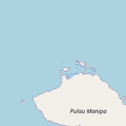
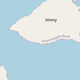
Manipa Island is an island in West Seram Regency, Maluku Province, Indonesia. It is located 8 km off the western coast of Kelang (from which it is separated by the Kelang Strait) at the western end of Seram Island and 25 km off the western coast of Buru.
Nº Q115401971 ★★
Peu commune · Lieux
Manipa
Island in Western Seram Regency, Maluku Province, Indonesia
Manipa Island is an island in West Seram Regency, Maluku Province, Indonesia. It is located 8 km off the western coast of Kelang (from which it is separated by the Kelang Strait) at the western end of Seram Island and 25 km off the western coast of Buru.
Sur la carte
Dernier prix
—
Prix plancher
—
Médiane 7 j
—
Ventes 30 j
0
Fourchette 30 j
—
En circulation
0
Cours
médiane
min – max
ventes
Aucune vente sur la période
Voir le tableau
| Date | médiane | Min | Max | ventes |
|---|
Historique des ventes
- Dernière vente
- —
- Moyenne 30 j
- —
- Plus bas 30 j
- —
- Plus haut 30 j
- —
- Ventes 7 j
- 0
- Ventes 30 j
- 0
Aucune vente pour l'instant.
Ventes anonymes : ni acheteur ni vendeur. Les chiffres ne comptent que les ventes entre joueurs.
Sur Wikipédia
Texte en anglais Pas encore d'article dans ta langue : extrait en anglais.
Manipa Island is an island in West Seram Regency, Maluku Province, Indonesia. It is located 8 km off the western coast of Kelang (from which it is separated by the Kelang Strait) at the western end of Seram Island and 25 km off the western coast of Buru. Including adjacent small islands, it forms an administrative district (kecamatan) within the regency, with its district centre at Masawoi. The district covers an area of 159.71 km2 and had a population of 7,165 at the 2020 Census; the official estimate as at mid 2023 was 7,793. There are 7 villages (desa), listed with their populations according to the official estimates as at mid 2022: Luhutuban (3,288), Tuniwara (865), Buano Hatuputih (359), Tomalehu Barat (1,057), Tomalehu Timur (285), Kelang Asaude (889) and Masawoi (727). The inhabitants speak the Manipa language, as well as Indonesian and Ambonese Malay. This island gives its name to the Manipa Strait between Buru and Seram.
Texte : Wikipédia en anglais, CC BY-SA 4.0. · Image : Пролив_Манипа.svg: Das steinerne Herz derivative work: Das s... (CC BY-SA 3.0) ·
Cartes voisines

West Seram Regency
Subdivision administrative de la province de Maluku, en Indonésie
Nº Q18942 ★★★★

Seram Bagian oriental
Subdivision administrative d'Indonésie
Nº Q16569 ★★★★
Kairatu
District indonésien
Nº Q12488495 ★★

Maluku central
Département indonésien
Nº Q4201768 ★★★★★
Kota Masohi
District indonésien
Nº Q6783501 ★★★★

Kabupaten de Mappi
Subdivision administrative d'Indonésie
Nº Q27679 ★★★★