
Albera Massif
Mountain range in Spain and France
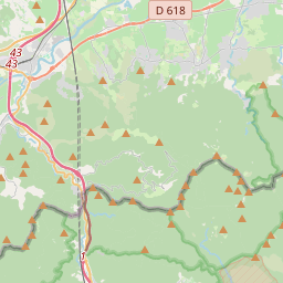
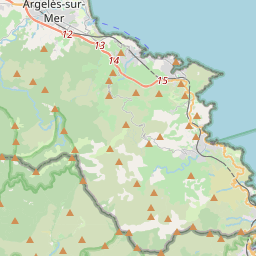
The Albera Massif (Catalan: Serra de l'Albera; Occitan: Massís d'Albera; French: Massif des Albères) is a mountain range located in the south of Pyrénées-Orientales and the north of Catalonia, between France and Spain. It is the main easternmost prolongation of the Pyrenees.
Nº Q1624531 ★★★
Rara · Lugares
Albera Massif
Mountain range in Spain and France
The Albera Massif (Catalan: Serra de l'Albera; Occitan: Massís d'Albera; French: Massif des Albères) is a mountain range located in the south of Pyrénées-Orientales and the north of Catalonia, between France and Spain. It is the main easternmost prolongation of the Pyrenees.
No mapa
Último preço
—
Preço mínimo
—
Mediana 7 d
—
Vendas 30 d
0
Faixa 30 d
—
Em circulação
0
Cotação
mediana
mín – máx
vendas
Sem vendas no período
Ver tabela
| Data | mediana | Mín | Máx | vendas |
|---|
Histórico de vendas
- Última venda
- —
- Média 30 d
- —
- Mínima 30 d
- —
- Máxima 30 d
- —
- Vendas 7 d
- 0
- Vendas 30 d
- 0
Ainda sem vendas.
Vendas anônimas: sem comprador nem vendedor. Os números contam só vendas entre jogadores.
Na Wikipédia
Texto em inglês Ainda não há artigo no seu idioma: trecho em inglês.
The Albera Massif (Catalan: Serra de l'Albera; Occitan: Massís d'Albera; French: Massif des Albères) is a mountain range located in the south of Pyrénées-Orientales and the north of Catalonia, between France and Spain. It is the main easternmost prolongation of the Pyrenees. Its highest peak is the Puig Neulós, with an elevation of 1,256 metres. Most of the southern side of the range is part of the Paratge Natural d'Interès Nacional de l'Albera natural reserve. There are some ancient megaliths in the range. The Col du Perthus marks the western boundary of the massif. The massif is at the eastern end of the "Axial Zone" of the Pyrenees mountain range. As in most of that zone, the geological formations in the massif are mostly of Paleozoic and earlier ages, with granite, gneiss, and schists (and other metasediments) being the predominant formations. On the northern slopes of the massif, the Albères fault (which runs roughly west to east from near Le Boulou to near Argelès) marks a clear geological and topographical boundary between the Palaeozoic and older formations of the Albera massif and the Neogene deposits of the Roussillon basin.
Texto: Wikipédia em inglês, CC BY-SA 4.0. · Imagem: AC at French Wikipedia (Public domain) ·
Cartas próximas

Col du Perthus
Mountain pass on the France–Spain border
Nº Q2982308 ★★

Galician Massif
Mountain ranges in Spain
Nº Q3327031 ★★

Gran Encantat
Mountain in Spain (European Union)
Nº Q3053720 ★★

Puigmal
Montanha dos Pirineus
Nº Q17477 ★★★

Aiguilles d'Arves
Mountain
Nº Q1607125 ★★★

Penyagolosa
Mountain in Spain
Nº Q3571460 ★★★