
Dokos shipwreck
Oldest discovered underwater shipwreck
The Dokos shipwreck is the oldest underwater shipwreck discovery known to archeologists. The wreck has been dated to the second Proto-Helladic period, 2700–2200 BC.
Nº Q5288773 ★
Comum · Lugares
Dokos shipwreck
Oldest discovered underwater shipwreck
The Dokos shipwreck is the oldest underwater shipwreck discovery known to archeologists. The wreck has been dated to the second Proto-Helladic period, 2700–2200 BC.
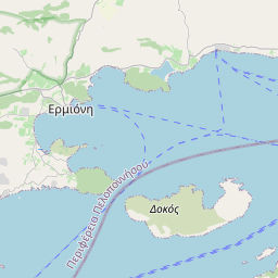
No mapa
Último preço
—
Preço mínimo
—
Mediana 7 d
—
Vendas 30 d
0
Faixa 30 d
—
Em circulação
0
Cotação
mediana
mín – máx
vendas
Sem vendas no período
Ver tabela
| Data | mediana | Mín | Máx | vendas |
|---|
Histórico de vendas
- Última venda
- —
- Média 30 d
- —
- Mínima 30 d
- —
- Máxima 30 d
- —
- Vendas 7 d
- 0
- Vendas 30 d
- 0
Ainda sem vendas.
Vendas anônimas: sem comprador nem vendedor. Os números contam só vendas entre jogadores.
Na Wikipédia
Texto em inglês Ainda não há artigo no seu idioma: trecho em inglês.
The Dokos shipwreck is the oldest underwater shipwreck discovery known to archeologists. The wreck has been dated to the second Proto-Helladic period, 2700–2200 BC. The remains of the shipwreck are located about 15–30 metres (50–100 ft) underwater off the coast of southern Greece near the island of Dokos (ancient name Aperopia) in the Aegean Sea. Dokos is about 100 kilometres (60 mi) east of Sparta, Peloponnese. The ship itself is long gone, as everything biodegradable has been dissolved by the sea. The only surviving evidence of the shipwreck is a cargo site of hundreds of clay vases and other ceramic items that were carried aboard the ship. These four-thousand-year-old remains were discovered by American archeologist Peter Throckmorton on August 23, 1975. The Dokos wreck site was extensively excavated between 1989 and 1992 by the Hellenic Institute of Marine Archaeology (HIMA). Archaeologist Dr. George Papathanasopoulos, President of HIMA, conducted the first ever full-scale excavation in Greece of an ancient shipwreck. Due to the irregularity of the seabed, a new system, the Sonic High Accuracy Ranging and Positioning System (SHARPS), was used to plot and map the underwater finds. Additional surveys were conducted and speculation that the remains dated to the Early Helladic period was confirmed.
Texto: Wikipédia em inglês, CC BY-SA 4.0. · Imagem: Greece_location_map.svg: Lencer / derivative work: Uwe Deder... (CC BY-SA 3.0) ·


