
Dokos shipwreck
Oldest discovered underwater shipwreck
The Dokos shipwreck is the oldest underwater shipwreck discovery known to archeologists. The wreck has been dated to the second Proto-Helladic period, 2700–2200 BC.
Nº Q5288773 ★
Commune · Lieux
Dokos shipwreck
Oldest discovered underwater shipwreck
The Dokos shipwreck is the oldest underwater shipwreck discovery known to archeologists. The wreck has been dated to the second Proto-Helladic period, 2700–2200 BC.
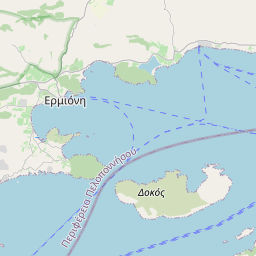
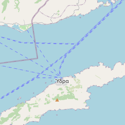
Sur la carte
Dernier prix
—
Prix plancher
—
Médiane 7 j
—
Ventes 30 j
0
Fourchette 30 j
—
En circulation
0
Cours
médiane
min – max
ventes
Aucune vente sur la période
Voir le tableau
| Date | médiane | Min | Max | ventes |
|---|
Historique des ventes
- Dernière vente
- —
- Moyenne 30 j
- —
- Plus bas 30 j
- —
- Plus haut 30 j
- —
- Ventes 7 j
- 0
- Ventes 30 j
- 0
Aucune vente pour l'instant.
Ventes anonymes : ni acheteur ni vendeur. Les chiffres ne comptent que les ventes entre joueurs.
Sur Wikipédia
Texte en anglais Pas encore d'article dans ta langue : extrait en anglais.
The Dokos shipwreck is the oldest underwater shipwreck discovery known to archeologists. The wreck has been dated to the second Proto-Helladic period, 2700–2200 BC. The remains of the shipwreck are located about 15–30 metres (50–100 ft) underwater off the coast of southern Greece near the island of Dokos (ancient name Aperopia) in the Aegean Sea. Dokos is about 100 kilometres (60 mi) east of Sparta, Peloponnese. The ship itself is long gone, as everything biodegradable has been dissolved by the sea. The only surviving evidence of the shipwreck is a cargo site of hundreds of clay vases and other ceramic items that were carried aboard the ship. These four-thousand-year-old remains were discovered by American archeologist Peter Throckmorton on August 23, 1975. The Dokos wreck site was extensively excavated between 1989 and 1992 by the Hellenic Institute of Marine Archaeology (HIMA). Archaeologist Dr. George Papathanasopoulos, President of HIMA, conducted the first ever full-scale excavation in Greece of an ancient shipwreck. Due to the irregularity of the seabed, a new system, the Sonic High Accuracy Ranging and Positioning System (SHARPS), was used to plot and map the underwater finds. Additional surveys were conducted and speculation that the remains dated to the Early Helladic period was confirmed.
Texte : Wikipédia en anglais, CC BY-SA 4.0. · Image : Greece_location_map.svg: Lencer / derivative work: Uwe Deder... (CC BY-SA 3.0) ·
Cartes voisines

Épave de Kyrénia
Épave d'un navire grec du IVe siècle avant J.C.
Nº Q2234980 ★

Dodone
Site archéologique en Grèce
Nº Q382317 ★★★

épave de Bajo de la Campana
Épave phénicienne découverte au large de Murcie, Espagne
Nº Q65006224 ★

MV Panagiotis
Cargo ship built in 1937
Nº Q3841717 ★★★

Dákos
Mezzé traditionnel grec
Nº Q762285 ★★★★

Euripe
Détroit qui sépare l'Eubée de la Béotie en Grèce
Nº Q1137741 ★★