
Bhimtal
Town and municipality in Nainital district, Uttarakhand, India
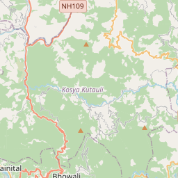
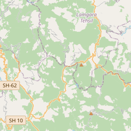
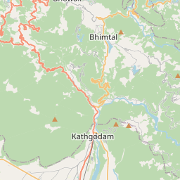
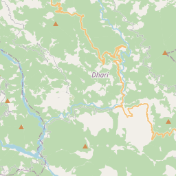
Bhimtal ([bʱiːmˈtaːl]; Devanagari: भीमताल, Kumaoni: [bʱiːmˈtaːl]) is a municipal town, administrative tehsil headquarters, and intermontane lacustrine basin situated in the Nainital district of the northern Indian state of Uttarakhand. Located in the Outer Lesser Himalayas at an altitude of 1,370 metres (4,495 feet) above mean sea level, the town lies 22 kilometres east of Nainital, 21 kilometres north of the railway terminus at Kathgodam, and 30 kilometres north of the regional commercial centre of Haldwani.
Nº Q795774 ★
Comum · Lugares
Bhimtal
Town and municipality in Nainital district, Uttarakhand, India
Bhimtal ([bʱiːmˈtaːl]; Devanagari: भीमताल, Kumaoni: [bʱiːmˈtaːl]) is a municipal town, administrative tehsil headquarters, and intermontane lacustrine basin situated in the Nainital district of the northern Indian state of Uttarakhand. Located in the Outer Lesser Himalayas at an altitude of 1,370 metres (4,495 feet) above mean sea level, the town lies 22 kilometres east of Nainital, 21 kilometres north of the railway terminus at Kathgodam, and 30 kilometres north of the regional commercial centre of Haldwani.
No mapa
Último preço
—
Preço mínimo
—
Mediana 7 d
—
Vendas 30 d
0
Faixa 30 d
—
Em circulação
0
Cotação
mediana
mín – máx
vendas
Sem vendas no período
Ver tabela
| Data | mediana | Mín | Máx | vendas |
|---|
Histórico de vendas
- Última venda
- —
- Média 30 d
- —
- Mínima 30 d
- —
- Máxima 30 d
- —
- Vendas 7 d
- 0
- Vendas 30 d
- 0
Ainda sem vendas.
Vendas anônimas: sem comprador nem vendedor. Os números contam só vendas entre jogadores.
Na Wikipédia
Texto em inglês Ainda não há artigo no seu idioma: trecho em inglês.
Bhimtal ([bʱiːmˈtaːl]; Devanagari: भीमताल, Kumaoni: [bʱiːmˈtaːl]) is a municipal town, administrative tehsil headquarters, and intermontane lacustrine basin situated in the Nainital district of the northern Indian state of Uttarakhand. Located in the Outer Lesser Himalayas at an altitude of 1,370 metres (4,495 feet) above mean sea level, the town lies 22 kilometres east of Nainital, 21 kilometres north of the railway terminus at Kathgodam, and 30 kilometres north of the regional commercial centre of Haldwani. The physical geography of the settlement is structured around Bhimtal Lake, a natural freshwater body covering 47.8 hectares, representing the largest lake by surface area in the Kumaon division. The lake features a natural volcanic bedrock island situated 91 metres from the southern dam embankment that accommodates a municipal public aquarium accessible by passenger ferry boats. In October 2023, the Government of Uttarakhand formally elevated Bhimtal from a Nagar Panchayat to a Class-III Nagar Palika Parishad. The town serves as an administrative hub hosting Vikas Bhawan, which accommodates the decentralized district rural development, agricultural, educational, and social welfare directorates for Nainital district.
Texto: Wikipédia em inglês, CC BY-SA 4.0. · Imagem: Samuel Bourne (Public domain) ·
Cartas próximas
Hinagu
Dissolved municipality in Ashikita district, Kumamoto prefecture, Japan
Nº Q24867915 ★★
Shiranuhi, Kumamoto
Dissolved municipality in Uto district, Kumamoto prefecture, Japan (1956-2005)
Nº Q7498273 ★★

Minami-ku, Kumamoto
One of the five wards of the City of Kumamoto, Japan
Nº Q876960 ★★★
Uto District, Kumamoto
Former district in Kumamoto prefecture, Japan
Nº Q7902917 ★★

Amatsukominato, Chiba
Dissolved municipality in Awa district, Chiba prefecture, Japan
Nº Q4740635 ★

Kumamoto 4th district
Legislative district of Japan
Nº Q11568330 ★★★